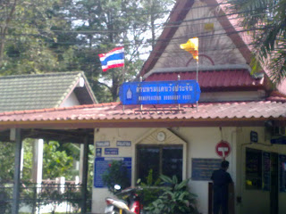
Koh Lipe is located in Satun province; roughly 65 km off the coast at the edge of Tarutao National Marine Park. It is near a group of around 50 uninhabited island with deserted beaches, waterfalls, and breathtaking viewpoints to visit.
Koh Lipe is home to some six hundred Chao Lei people who are descended from 'sea gypsies' that have lived on the Andaman coast for centuries. Masters of the sea, the Chao Lei settled on Koh Lipe when the King of Thailand offered them citizenship and land in return for settling the island, and thus at the time helping to fix Thailand's southern sea border with Malaysia.
Not so reliant on the sea as they once were, the local community is adapting to the changes tourism are bringing.This development includes dive schools, an increasing number of resorts, and a tacky "walking street" (named after an infamous stretch in South Pattaya).
However, if you can ignore the unfortunate aspects of development, Koh Lipe is a great beach holiday destination albeit not in the rainy season. The island is surrounded by beautiful coral reefs and ocean marine life perfect for snorkeling and scuba diving.
Short stories of my many trips around Thailand - sun, sand, sea, temples, and good food.
Showing posts with label Satun. Show all posts
Showing posts with label Satun. Show all posts
Wednesday, October 10, 2012
Saturday, September 24, 2011
Satun - Thale Ban National Park
Satun is the southernmost on Thailand's west coast, bordered to the south by Malaysia. Satun is one of four Thai provinces with Muslim-majority population.
The province is a must-explore province for beach-lovers - the islands, e.g., Koh Tarutao and Koh Lipe are stunning. However, this blog is about main-land Satun. which turned out to be a big positive surprise for me..
The same-named provincial capital of Satun is a decidedly sleepy affair, but that it its charm.
For example, at the local branch of the National Museum, I was probably the only visitor that afternoon so both (sic!) staff took it upon themselves to give me a guided tour. However, as tourists rarely come to town, the tour was in Thai as the staff wasn't proficient in English.
 Satun is mostly mountainous, with plains flattening out the central and coastal areas. The province is also home to Thale Ban National Park, easily visited on motorcycle from the provincial capital.
Bung Thale Ban is a large swamp that is situated in the middle of a valley and surrounded by Chin and Wang Pra mountains. In the mountains, there are several beautiful waterfalls and caves. Communist insurgents are said to have hidden themselves in some of the caves during the 1970s.
The swamp covers an area of 320 square kilometers and is full of freshwater fish and shells. There is an abundance of Bakong trees around the swamp.
Nearby is the almost never-used Wang Prajan border post for crossing into Malaysia.
The province is a must-explore province for beach-lovers - the islands, e.g., Koh Tarutao and Koh Lipe are stunning. However, this blog is about main-land Satun. which turned out to be a big positive surprise for me..
The same-named provincial capital of Satun is a decidedly sleepy affair, but that it its charm.
For example, at the local branch of the National Museum, I was probably the only visitor that afternoon so both (sic!) staff took it upon themselves to give me a guided tour. However, as tourists rarely come to town, the tour was in Thai as the staff wasn't proficient in English.
 Satun is mostly mountainous, with plains flattening out the central and coastal areas. The province is also home to Thale Ban National Park, easily visited on motorcycle from the provincial capital.
Bung Thale Ban is a large swamp that is situated in the middle of a valley and surrounded by Chin and Wang Pra mountains. In the mountains, there are several beautiful waterfalls and caves. Communist insurgents are said to have hidden themselves in some of the caves during the 1970s.
The swamp covers an area of 320 square kilometers and is full of freshwater fish and shells. There is an abundance of Bakong trees around the swamp.
Nearby is the almost never-used Wang Prajan border post for crossing into Malaysia.
Labels:
national park,
nature,
Satun,
Thailand,
travel
Monday, August 1, 2011
Satun - Funny Road Signs

I want to show a couple of the funny road signs I came across in Satun.
One sign seems to forbid deer access to a forest. However, the text states that hunting / killing deer is not allowed.
Another sign states that there is an accident ahead. So, supposedly the "accident" has been there for a long time and nobody has any intention of removing the accident. It's better to simply warn people that the accident is there up ahead.
The sign is of course intended to be a warning of a high risk "black spot" where accidents occur frequently. In this case, it was a 90 degree turn, where apparently many motorists got surprised and instead continued straight off the road.

For a foreigner, one positive aspect of driving around Thailand is that many signs are in dual language - even signs that in my view are totally irrelevant for foreigners.
For example: "Weighing Station Ahead: All Trucks Must Stop" - I think there are very few foreigners cruising around Thailand in 10-wheel trucks.
Subscribe to:
Posts (Atom)


