Showing posts with label off road. Show all posts

Thursday, February 5, 2015

Sa Kaeo - Pang Sida

Pang Sida National Park is not famous and doesn't get that many visitors. It is a part of the quintet of national parks that laymen simply refer to a "Khao Yai" and borders to the north and west to Tublan National Park.
Where has all the water gone?
Pang Sida Waterfall is about 10 meters tall, but it is without water flow during the dry season. Nearby is one of a handful of locations where butterflies gather by the hundreds if not thousands. Another such location is the viewpoint reached after 25 km on gravel road.
The view to be had is over the Samong River Valley, which is between 5-8 km wide, up to 500 meters "deep" and its many creeks feeds over 250 million cubic meters of water annually into the Prachinburi River.

To me, the trip to get to the viewpoint was much more interesting than the view. At the entrance to the park, the park ranger joked that I should watch out for the wild elephants. There was, however, some truth to that warning. Wild elephants had left many signs behind that they had rummaged around, but fortunately, they apparently mostly do that in the night or morning, so I didn't actually see any wild elephants. Nor did I see any gaurs. But I did see many wild boars, some pheasants, and a deer of some sort.

The road was not a challenge by any stretch of the imagination - no need for 4WD - but I did encounter some road signs that made me smile.
Somebody should bring this insubordinate road to order
Everybody needs a rest from time to time
However funny the wording in English is, the meaning did come across to me: Slow down. And the picture below shows what the signs were meant to convey.
Well, the road does look worn out
Please also note that freshwater crocodiles were "discovered" in 1991 at Huay Nam Yen Stream near the south-west corner of the park. As it apparently is the last place in Thailand freshwater crocodiles live in the wild, it is an interesting side tour to visit that site.

Friday, October 17, 2014

Nakhon Ratchasima - Tublan Adventure

I went in search of Khao Phang Ma view point on edge of Tublan National Park in the hope of being able to see some gaurs (wild Indian bison or oxen) from afar.

The viewpoint (hill) was not easy to find. Directions on internet were contradictory and my two GPS gave two different locations. I opted for one of these locations. When I missed a turn, the GPS then immediately indicated a short-cut. This turned out to be the worst advice ever given.

The short-cut lead me to drive down a steep muddy descent (no way of getting back up that slippery slope), cross a creek, drive on an overgrown rarely used track, crawl between two small lakes, and then face a muddy incline. It looked easy, but I ended up sliding back down again and again and eventually got stuck. After numerous attempts of digging and piling stones into the ever deeper holes my tires dug, I went for help.

I encountered two national park rangers (apparently, at the steep decline was where I entered the national park), but after some pushing, they came to the same conclusion as me: truck dug in too deep.

Then they went to a nearby village and came back with a guy on a 4WD tractor. He pulled me (backwards) up from the hole, but in the mud, my pick-up started sliding to the left, down towards a small lake. He continued to pull me backwards but jerked to the right. The over-compensation resulted in the truck sliding directly into the bigger lake on the right of the narrow track.

From stuck, I was now REALLY stuck and partly under water.

His 4WD tractor could not pull me anywhere. He sent for a guy with a bigger tractor. 
Disaster has struck
However, rather than pulling me up, he almost ended up being stuck on the same hill where I had encountered problems. After much maneuvering, all his tractor did was making the mud even deeper and stickier.

The guys then sent for a manual winch. After some hard work, the truck got half way out of the water. They sent for another manual winch. The truck got almost out of the water.

Now, while all this is going on, it drizzles but increasing quantities of Thai whisky is being consumed so everybody is in a good mood. In fact, a couple of more guys (and a tractor) arrive to part take in the drinking and winching. People jump into and out of the lake in order to wash off the mud and there is almost a party mood while the dusk settles.

Around six hours have passed and there were now 6-8 villagers taking part in the rescue operation ("taking part" includes mostly drinking). Then a 4WD tractor finally pull the pick-up backwards and up from the lake.
Up it finally comes
Finally up on terra firma. I made a U turn. Winches and people were piled up in the back up my truck. Then, there was the issue that ... I could not go the same way back as I then would have to climb (in the dark) the steep muddy incline where I had first entered the national park.

So, after some palaver, the least drunk villager suggested to chain my truck to a tractor and pull me along a barely visible track through the national park. At one spot, I got stuck again. After several attempts, I got pulled up that hill by two tractors.

The worst was over. The last couple of kilometers, the track was still very muddy, but without inclines so I powered through and out.

Then it was time for dinner (and more whisky) with the rescuers who also received some cash hand outs for their time and efforts without which my truck would still be stuck in that lake.

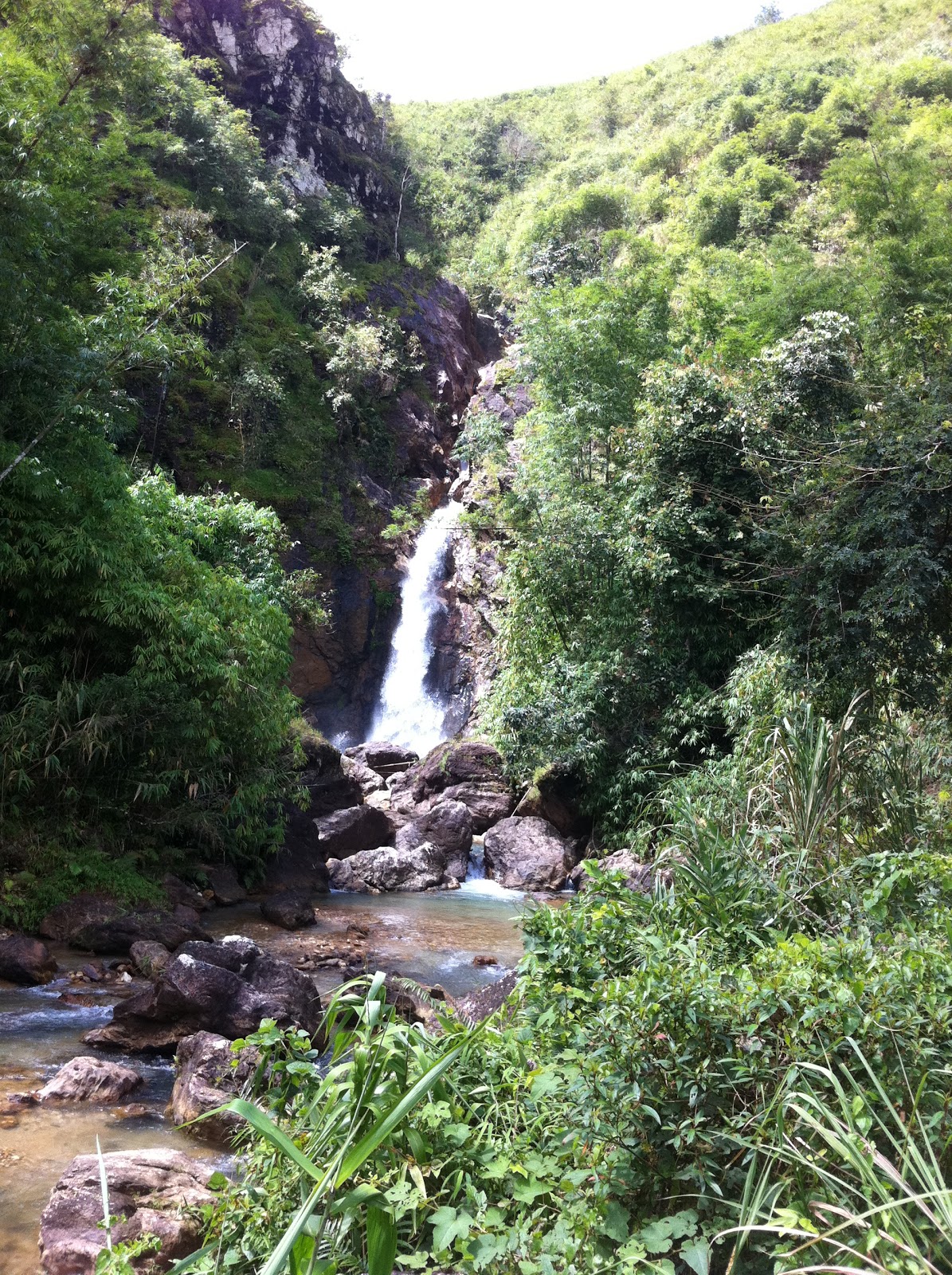
Next day, I easily made it to the viewpoint without taking any shortcuts.

Friday, October 10, 2014

Nakhon Ratchasima - Khao Phaeng Ma

This hill, which apparently to some resembles the neck of a horse, is located in Wang Nam Khiao district between the borders of Prachinburi Province and Tublan National Park. The peak is 850 meters above sea level. The viewpoint is relatively easy to reach, only four kilometers from the main road. The last part is a rugged dirt road, but I saw several sedans make the trip.
Upon reaching the top, there are views towards Tublan. The Khao Phaeng Ma forest area is under the care of the Wildlife Foundation of Thailand. It covers an area of 16 square kilometers. Activities include trekking along an 1,800 meter track and animal watching.

The main attraction is to spot some of the few remaining wild gaurs. A gaur is a dark-coated bovine native to Southeast Asia and the Indian Subcontinent. It can grow bigger than the African buffalo and water buffalo. It is also in the context of Indian safari tourism called Indian bison.

In Thailand, the gaur is nearly extinct, but has found a safe haven in Tublan, especially in and near the Khao Phaeng Ma forest area. However, gaurs do on occasion venture outside their designated habitat as nearby corn fields provide tempting appetizers.

If you have patience, luck, and a telescopic lense, you can catch a glimpse of gaurs gathering around a salt lick. If not, you can pose with the gaur statue erected at the viewpoint.


Tuesday, August 5, 2014

Uthai Thani - Thung Yai Naresuan – Huai Kha Khaeng Wildlife Sanctuary

The Thung Yai Naresuan – Huai Kha Khaeng Wildlife Sanctuary was registered as a World Heritage Site by UNESCO in December 1991.

http://whc.unesco.org/en/list/591

It covers 5,775 square kilometers across three provinces: Uthai Thani, Kanchanaburi; and Tak. It is the largest connected conserved forest in Thailand and the South East Asia Region. To me, the important aspects of this national park is that it really is a sanctuary for wildlife (public access is more restricted than in normal national parks) and that it is so solely due to the work and sacrifice of one individual.

Visitors to the wildlife sanctuary are restricted to three relatively small areas. There are nature study routes (trekking) where one can enjoy flora and fauna. The national park area is so huge that one can only get to experience a tiny part of it. Today, it is a popular destination for groups of off-road enthusiasts who don't come to appreciate nature but to tear through the forest in their 4x4.

At the headquarters of the wildlife sanctuary, there is a statue of Seub Nakhasathien, the man who valiantly fought to preserve what remained of Thailand's forests. He was head of the sanctuary for eight months until he was overcome with despair over the obstacles he faced.

Seub Nakhasathien
 He is quoted as having said: "Personally, I'd rather do conservation research than focus entirely on trying to catch poachers and loggers. The people we catch in the forest are just the workers, not the masterminds. Those who are really responsible, the influential people who arrange and gain all the benefits from the illegal forest activity are never caught. The legal process doesn't apply to them."

For more info on this amazing person:  http://www.seub.or.th/

Near the headquarters, there is a memorial for the park rangers that have been killed while patrolling the wildlife sanctuary. Like khun Seub, these rangers paid the ultimate price in the fight against poaching and illegal logging.

Sunday, May 25, 2014

Chantaburi - a multitude of options

Chantaburi has something for everyone. The province has great beaches, highlands with waterfalls and hot springs, remnants of gem mines as well several destinations for history buffs. In a temple in the city center, Buddha statues are kept in a building with a roof shaped like the helmet worn by the great Taksin who won Siam back from the Burmese.
Chantaburi was from where the general (later king) gathered his forces, built his fleet, and subsequently launched his attack on the Burmese. Later, Siam came under pressure from the expansionist French that didn't think French Indochina was quite large enough. French troops therefore marched up the coast from today's China and didn't stop until they reached Chantaburi. 
French-built "Chicken-shit Prison"
They occupied the territory until the king of Siam gave two of "his" Cambodian provinces to the French. The French combined incarceration of Thai prisoners with farming - there is a structure near Laem Singh, which used to have prisoners on the ground floor while the top floor was a chicken coop. Due to gravity, the prisoner were "showered" in chicken droppings, which they obviously saw as a great insult.

Beach destinations include Laem Singh and Hat Chao Lao (with Laem Sadet)

http://tinamue.blogspot.com/2011/12/chantaburi-laem-singh.html


http://tinamue.blogspot.com/2010/02/chantanaburi-chao-lao.html

The road from Chantaburi city to Sa Kaeo city goes parallel to the Thai border with Cambodia and there are a couple of small "border markets" and lots of waterfalls along the way. The key destination in that area is Soi Dao.
Rolling hills near Soi Dao

Wednesday, February 5, 2014

Phrae - Mountains

Apart from Phae Muang Phi and temples, Phrae is of course famous in Thailand for its mountainous topography and cold winter nights. During the cold season, especially over the New Year holidays, many Thais from the central and coastal regions travel north to experience cold weather as temperatures can drop to around 10 degrees Centigrade. To them, it is a bliss to freeze a bit next to a mountain stream, so for resorts and hotels up north, the cold season is the high season.
Home Stay Mountain Style
I am not sure whether 1,000 meter peaks meet the international standard for mountains (or whether any such standard exists), but towards the borders with Uttaradit and Nan, Phrae has lush mountains with great views and plenty of waterfalls to explore.
Choeng Thong Waterfall
I have seen too many waterfalls to be excited about seeing one more or one less. I have a tendency to seek out the less-traveled roads although they often are not short cuts. In the mountains, there were several of these roads that went winding on forever without taking me anywhere.
Why should we get outta the way?


Monday, September 9, 2013

Ratchaburi - Khao Krajom (2)

In an earlier blog, I vowed to return to Ratchaburi and drive to the top of Khao Krajom during the rainy season.

http://tinamue.blogspot.com/2013/04/rachaburi-khao-krajom.html

As expected, what had been a walk in the park when the track was bone dry, had now become more challenging. Whereas use of 4WD was merely a recommendation during the dry season, it is a must during the rainy season. And yet, there were only two spots where one had to use the low range and had to be stubborn.

One was a stretch with deep ruts cut by rain water. The computerized traction control (limited slip differential) failed. Limited slip does obviously not mean no slip. Without manual differential locks, the wheel not touching the road spun and no power was transferred to the wheels touching the ground. It took several attempts to find a route up the ascent where the worst ruts were avoided and forward (upward) motion maintained.

The second problem was the very steep final stretch before the peak is reached. It took 3-4 attempts before I found a route where I could gain sufficient speed and traction to power my way up the hill. Again, without manual differential locks, I had to do the climb without finesse.

But I made it to the top.
Khao Krajom - View towards Burma

Sunday, August 25, 2013

Kanchanaburi - Huay Mae Kamin Waterfall

There are too many waterfall in Kanchanaburi to mention them all. Some are stunning (like the Erawan falls), while others are merely interesting.

Huay Mae Kamin was a present surprise at the end of an adventurous journey
Huay Mae Kamin Waterfall Level 4
After I had to interrupt an earlier adventure due to lack of fuel

http://tinamue.blogspot.com/2010/03/kanchanaburi-off-beaten-track.html

I this time filled my tank in advance and before again attempting to drive back from Thong Pha Phum along the western fringe of the reservoir behind the Sri Nakharin dam. It worked out well and it was a nice off road experience that by coincidence brought me to the Huay Mae Kamin waterfall.

Of course, everybody else at the waterfall had come the easy way - entered the Khuean Srinagarindra National Park from the south.

Saturday, April 20, 2013

Rachaburi - Khao Krajom


Khao Krajom as most road-signs say (or is it Khao Khrachom as some signs say?) is a mountain top near the border to Myanmar. It is located in Suan Pheung district in Ratchaburi. One the summit, there are camping sites, basic facilities, good views, and a quiet calm as one truly feels far away from the hustle and bustle of everyday life.
Map on sign near creek crossing
To reach the peak at over 1,000 meters above sea level is a challenge many Thai 4WD enthusiasts take on with gusto. During the dry season, it is not much of a challenge. However, the use of 4WD is recommended as one needs to secure grip on a “loose” surface.
Now track is dry and hard, but appears to be soft and slippery during rainy season.
The road from “civilization” to the peak is roughly 8 kilometers, which during the dry season can covered in around 30 minutes. During the rainy season, it takes 40-50 minutes. The first third of the 8 km is paved. During the dry season, the second half gets bumpy and dusty, but is not particularly challenging except for 2-3 spots that require a little bit “extra”.
River or rather creek to be crossed
One spot is a river crossing where people have to overcome mental blocks they may have that prevent them from driving through water. Water depth is unknown and potholes or obstacles can be hidden in the muddy water. I took the optimistic perspective that plenty of other vehicles had crossed before me. So, although alone in the wilderness at the time, I assumed that if those vehicles could cross, so could my vehicle.

To prove it could be done, I crossed back and forth six times. Despite water reaching ten inches up my doors, thus submerging my exhaust pipe in water for over a minute, the engine didn’t stall and no water entered the cabin. However, each time on the way back across the river, the tires would lose grip on the slippery pebbles on the river bed. Each time this happened, it sent some “what-if” thoughts racing through my mind.
The other trouble spots were some steep ascents – most notably the last 300 meters to the peak – where lose rocks and/or soft sand on top of a hard lateritic road surface made wheel spin inevitable. The only way to overcome this was to use the 4WD low range and climb slowly but methodically.
Top of Khao Krajom is within reach, but a final steep ascent awaits.
Except for these steep ascents, the rest of the road can easily be handled in 4WD high range by powering through in second gear and controlling wheel spins on sandy surfaces as / when they happen. Or one can make the journey at a more leisurely pace to potentially sight some wildlife – all I saw was some pheasant hens and a long dark grey snake crossing the road.

I look forward to trying to reach Khao Krajom during the rainy season where I expect the road surface will be slippery due to mud.

Friday, January 25, 2013

Petchaburi - Panoen Thung


I visited the viewpoint before:


This time I noticed some warning signs that were way off the mark.
At least during the dry and hot seasons, the road is so good that there is absolutely no need for engaging 4WD, nor is there even on the steepest ascents a need to gear down to first gear. Most ascents can be done in third gear.
On the road to Panoen Thung as well as at the viewpoint, there are plenty of spots for bird watchers to frolic and butterfly enthusiasts can also find plenty of spots to enjoy their hobby. But getting to the viewpoint cannot be considered an off-road challenge.

This time, I went on the track that continues along the top of the ridge after having passed the viewpoint. However, after roughly seven kilometers, the park authorities had blocked the road, so I didn’t reach the waterfall. 

Thursday, January 3, 2013

Tak - Getting to Thi Lo Su

Before going, I heard many warnings about the tough conditions and Thai web-boards are full of warnings that the road to Thi Lo Su can only be driven by a 4WD vehicle.

I heard and read similar warnings before going to Panoen Tung and they turned out to be way off the mark.

http://tinamue.blogspot.com/2012/05/petchaburi-kaeng-krachan.html

The same can be said about warnings about getting to Thi Lo Su.

The distance from the entrance to Umphang Wildlife Sanctuary to the ranger station near the waterfall is around 26 km. Only pick-up trucks and SUVs are allowed onto the road, but 4WD is not compulsory. 

The 26 km cannot be said to be much of an off road challenge. I did most of the first half of the track in second gear and most of the second half in third gear. The road is better than the road to / from Somsak Mine

http://tinamue.blogspot.com/2012/02/kanchanaburi-somsak-mining.html

I just recently saw a Nissan X-Trail going to Somsak and Pilok without any problems, and if such a "baby-SUV" can handle a road, then it is not that bad.

On the way to Thi Lo Su, I only engaged 4WD twice when having to drive across some muddy parts of the road. However, I think that having the right tires (All-Terrain) is more important than using 4WD. As the picture shows, having standard Highway-Terrain tires and 2WD can leave you stranded when climbing a muddy and thus slippery patch.  

After having helped the two hapless 2WD Toyotas out of their muddy mess, a 4WD Toyota with AT tires showed how not to do. Like the others, he put pedal to the metal, presumably to gain momentum going up hill. But this caused the wheels to spin, so he almost got stuck despite having all the correct "hardware". I went up the hill in second gear supplying a steady measure of torque to the wheels and avoided wheel spin.

At another soft spot, another 4WD Toyota with AT got into a mess by driving too fast. Mud can hide serious bumps and pot holes. He banged his engine block into the ground and got stuck when his front suddenly dived into a hidden hole.

So, while the park rangers are correct in not requiring visiting vehicles to have 4WD, I recommend visitors to consider their tire choice and to ensure that vehicles have extra ground clearance. Cars obviously sink down in mud and several places I could see normal pick-ups had sunk in so deep that their "under belly" had scraped along the ground. 

Tuesday, January 1, 2013

Tak - Thi Lo Su Waterfall

Tak is most often bypassed as people head for the popular northern destinations of Chiang Mai, Chiang Rai or Pai. Nevertheless, Tak's serene beauty has steadily won travellers' hearts as Umphang has a lot to offer.

Located in the Umphang Wildlife Sanctuary, Thi Lo Su is a waterfall located 900 m above sea level with a height of several hundred meters and a width of 500 m. It is known as Thailand's largest waterfall, but locals told me there is an even higher waterfall only a few dozen kilometers away.

Thi Lo Su in Karen means a waterfall with a loud noise. Its water source comes from Klo Tho Stream supplying water for the waterfall all year round but the water will be more plentiful in the rainy season. However, access road is closed during the rainy season. 

Situated in the embrace of luxuriant vegetation, Thi Lo Su is supposedly most beautiful waterfall in Thailand and is reportedly ranked as the sixth most beautiful waterfall in the world.
Personally, I find that exaggerated.

However, since Thi Lo Su faces east, rainbows appear when water spray reflects the sunlight at a perfect angle. The air is refreshing. You can swim in its large pond with cool water. 
Camping is allowed in the Umphang Wildlife Sanctuary.

To get to Thi Lo Su, most visitors sail along the Mae Klong River and disembark at Tha Sai. Then a rented  "song taew" pickup takes them roughly 12 km to the main Umphang Wildlife Sanctuary ranger station. After that, one has to walk the last 1.6 km to reach Thi Lo Su. 

For those deciding to drive themselves rather than relying on others, I have prepared a second blog because I heard so many "horror stories" before I went.  But note that automobiles cannot access the Umphang Wildlife Sanctuary in the rainy season (June-October). During this period, visitors have to walk from Tha Sai to the waterfall. 


Wednesday, July 25, 2012

Petchabun - Thung Salaeng Luang National Park (2)

Let me repeat: The national park's headquarters is located at km. 80 on Highway No. 12. But cars are not allowed access to Thung Saleng Luang’s main savannah from the park headquarters. Cars have to enter the park at Nong Mae Na, i.e., from Khao Kho.
I repeat this because when checking both a couple of GPS as well as asking a few locals (or maybe not?) in Khao Kho, I was told to go to Highway 12. In other words, if I had not already visited this national park, I would not have found the correct entrance.

This visit was during the hot and dry season while my first visit was during the "cold" season:


http://tinamue.blogspot.com/2010/01/thung-salaeng-luang-national-park.html

It makes quite a difference. This time, the grass on the savannah was not as high (not as impressive) and park rangers had started several controlled fires in order to not risk that a bush fire ravages the park.

All in all, the dry season is not an interesting time to visit. Next time, I will try to make it during the rainy season as the tracks leading through the park then (hopefully) will be muddy, challenging and fun to drive.

Tuesday, May 15, 2012

Petchaburi - Kaeng Krachan

As Kaeng Krachan is Thailand's largest national park (see my blog April last year) it has many attractions, including a reservoir that can be used for fishing and kayaking, a golf course, whitewater rafting, waterfalls, and bird watching.

The most famous destination for people with a craving for a bit of rough road is the Panoen Thung "mountain". For those wishing to drive up to the campsite at Panoen Thung, timing is important.
From Bang Krang campsite, the road is in poor condition and certain times are allotted for ascent and descent. Times for going up are 5.30-7.30 am and 1:00-3:00 pm. Times for going down are 9:00-10:00 am and 4:00-5:00 pm.   


Driving to / from Panoen Thung is best done in a vehicle with good ground clearance and a solid suspension, but the drive is not an off-road challenge as there obviously is a (gravel) road. A standard saloon car can do the drive, but only during the dry season.


During the rainy season, it can at times be challenging to find traction, but the road is anyway closed during the months where 4WD potentially would be needed. So, the park rangers deprive us for a good opportunity to test our 4WD trucks and SUVs.


Although it definitely possible to reach the top in a saloon car during the dry season, due care has to be exercised by the driver. Whilst crossing the streams past Bang Krang campsite, the entry and exit from the streams' floors can be quite steep - quite a number of visitors have ripped parts of their cars' bodywork off at these streams.

Saturday, May 5, 2012

Ratchaburi - Off road

Before people venture off road in their vehicle, it is best to know what to expect. So, there are a couple of driving schools in Thailand that teach people how to drive the 4x4 way.
Thinking "better late than newer", I joined a weekend course held near Suan Peung in Ratchaburi. The school insists that you pass the "basic" program before they let you in on their "advanced" course.

They start up with a half day of theory (how does a vehicle "work", in general and with four-wheel drive in particular) and that part is a bit tough unless you are pretty fluent in Thai because the lessons are in Thai.

Then, the next half day is spent driving on a closed circuit - a controlled environment - to let the driver get used to what to do when driving up / down steep inclines / declines, through sand, through water, across narrow bridges etc.
After that, there is a night drive on narrow, bumpy, gravel roads. The next day, the cars and drivers get taken up and down, through and across the hills and pineapple fields near the school before the drive ends with some refreshments and coffee in Suan Peung .

The advance courses are held during the rainy season and the drivers are taken through muddy, slippery roads in the forest rather than on dry roads cutting through pineapple plantations.

Tuesday, February 21, 2012

Kanchanaburi - Off the beaten track (3)

In 2010, I visited the mines at Pilok and briefly mentioned it in a blog.


Last year, I visited Pilok and Somsak Mining Homestay and blogged about it recently. Here is a YouTube link that gives an idea of the drive down into the valley. 


Last year, before reaching Pilok, I stopped at Thong Pha Phum National Park to enjoy the views and to grab a cup of coffee before continuing. Just as we'd parked our cars, a big bird crash landed and started rummaging for food. 
A National Park officer came out and explained this bird had become so accustomed to people that it no longer was "shy" or scared of people. We even managed to hand-feed the bird some grapes before venturing on. 
The next stop before continuing to Somsak Mining (see previous blog) was Chokkadin (or Jokkadin) Waterfall. 

The road leading down to the waterfall has some steep declines / inclines and (especially during the rainy season) some deep ruts. If your vehicle slides into the deep tracks - as happened for my friend's pick-up - then even 4WD cannot ensure that you can get yourself unstuck without help. 

In our case, it required a lot of digging before the truck got out of trouble and back on the right track. 

We then continued and reached a grassy swampy area from where we walked to the waterfall. Other off-road people are so lazy that they continue driving on the river bed to reach the foot of the waterfall. This shows little respect for nature and can anyway not be recommended during the rainy season where the water level can be too high for a vehicle without snorkel to handle.

Saturday, February 11, 2012

Kanchanaburi - Somsak Mining

From Thong Pha Phun, off the main road from Kanchanaburi to Sanghklaburi, a narrow route, frequently blocked by landslides, twists through limestone mountains until it dead-ends at the Myanmar border.
Just before Pilok a sign indicates that there is 5.1 km to Somsak Mining Homestay, but warns that the road is rough and only suitable for 4WD vehicles. As usual, such claims are only partially true as there is sufficient traction in the dry season for a normal vehicle to handle the inclines and declines of the road. However, extra ground clearance is a must due to the rocky and pot-holed road, so while no sedan can possible handle the road, a 2WD Fortuner, Hilander or Prerunner should be able to get handle that road in the dry season.

In the rainy season, things can be a bit more challenging if/when rainwater erodes the surface of the already bumpy road.
At the end of the rough road, first time visitors are invariably amazed to discover a few small cottages suddenly popping up in a lush jungle valley. The homely resort is run by a smiling and welcoming farang “auntie”, Glennis, from Australia. She has quite a story to tell.
She met Somsak, a handsome young Thai studying at the school of mines in her hometown of Kalgoorlie. They got married and Glennis arrived in Thailand in 1966. Somsak went to run the tin mining concession that had been in his family’s hands for some 100 years. Pilok was back then a prosperous community. Cross-border trade flourished and the mines attracted workers from Myanmar.

Due to difficulties in accessing Pilok 40 years ago, Auntie Glen lived in Bangkok while Somsak came back to her and their son once a week. When the mining business faltered because of a sharp drop in the tin price, and Somsak got sick, Auntie Glen decided to move to Pilok. She fell in love with her new home in the jungle.
Somsak succumbed to cancer in 1994, a year after mining was halted at Pilok in wake of a worldwide slump in tin prices. Young people left to seek jobs elsewhere. Those who remain eke out a living among ramshackle buildings and forest huts.

Some 240 of Somsak’s former employees remain in the area, among them five families working for Auntie Glen and a Myanmar Buddhist monk taking care of their spiritual needs. Here our 4x4 are parked just outside the tiny temple, which is reached by crossing a small bridge. 
The homely resort consists of two long bungalows in the forest and the converted warehouse for dining and lounging, all imbued with a tropical atmosphere mingling with ceramic bunny rabbits, pastel colored duck-lings, doilies and other Australian Victoriana. There are no telephones and electric power runs just five hours a day.
However, the combination of comfortable weather and a cozy home in the jungle attract travelers - particularly off-roaders. Various stickers on the door indicate just how popular the resort is with various off-road clubs.

Driving from Somsak back to the main road, to Pilok and onwards to Myanmar will reward you with some amazing views. From atop, you can see a small village nestled in the valley below, right on the Thailand-Burma border. Huge gas pipes and telecommunication towers can be easily seen among the small old houses.
That is Ban E-Thong and the pipes are part of the Petroleum Authority of Thailand's 260km pipeline carrying gas from Burma's Yadana field in the Andaman Sea to supply a 4,600 megawatt power plant in Ratchaburi.

Once Ban E-Thong and Pilok were bustling tin-mining towns. Thousands of miners, hundreds of merchants, shops, theatres and a casino kept this place busy around the clock. As they are only located around 50 km from the sea, many Burmese merchants back then came weekly to offer fresh seafood at very good prices.

Now, these towns are very quiet. All the miners have gone, but groups of tourist are now coming. Guesthouses and coffee houses thrive (except in the rainy season) and locals are getting into the tourism business as more and more people discover the joys of hiding away in these remote border towns.

Thursday, February 2, 2012

Caravan

A phenomenon that has gained popularity in Bangkok is "caravan trips", i. e., group trips / tours by means of driving your own vehicle. At first, caravan trips were one or two days events to explore the areas near or around Bangkok. Since then, it has developed into trips lasting 5-15 days and going as far as to South Vietnam via Laos or to Southern China.
.
There are also caravans for special interests such as off-road driving and then you better prepare your car with snorkel, winch and A/T tires.

The increased interest in caravan trips was surely the inspiration for a very popular Thai movie from a few years back:

http://www.majorcineplex.com/movie_detail.php?mid=556


The movie is a romantic comedy where the background story is aa road trip through southern Vietnam (from Hue to Dalat) and the scenery is quite stunning. 

Monday, November 14, 2011

Kanchanaburi - Off the Beaten Track (Part 2)

Since my blog
http://tinamue.blogspot.com/2011/05/kanchanaburi-sangkhlaburi-4wd.html
that contained my opinion about Toyota Fortuner's (relatively) limited off-road capabilities, I have been asked to retract such "derogatory remarks".


So let me elaborate.
I have driven many SUVs and baby-SUVs and clearly vehicles with automatic gearshift and gasoline engines (such as Nissan X-trail and Honda CRV) fail miserably when facing real 4WD challenges like rocky or muddy mountain roads. The same can be said about a Toyota RAV4, but (at least with manual gearshift) it can be driven quite sportily, e.g., doing power slides through sharp turns on gravel roads. 

A Kia Sorento is also a 4WD vehicle, but it doesn't have the feel of a vehicle one would like to take off road. That being said, it's an awesome feeling to have a 3.5 liter gasoline engine rumbling under your foot. The 3.5 liter Mitsubishi Pajero has since 2008 strayed from being an off-road vehicle and is now a full option boulevard cruiser feeling under-powered compared to the Sorento.


Such baby-SUVs cannot hold a candle against rough-and-rumble vehicles like the Mercedes G-Wagon - it drives like a tank (heavy and unstoppable) but you can enjoy the ride in comfy leather seats - or the Toyota Landcruiser. Both, but especially the G-Wagon, are so superior off-road that they almost make such driving boring. 


(Let me add that I have a job situation that allows me to not worry about costs related to car ownership, maintenance, insurance or fuel consumption, and that has provided me with access to use a large number of different vehicles and drive in different countries over the years).


A Fortuner is not a baby-SUV, but a real SUV. That is, it is quite capable of handling relatively rough terrain while at the same time being quite comfortable on the hiway. Especially the version  powered by a 2.7 liter gasoline engine is a good drive on normal roads. Since that is where it's used most by most people, the lack of torque (compared to the 3.0 liter turbodiesel) for off road challenges is not that relevant. However, the increased fuel consumption probably is if one has to pay for what one consumes - something I fortunately don't have to, so I had great fun in the gasoline powered Fortuner also off road.
My points actually are:
* the Fortuner is an SUV, i.e., a multi-purpose vehicle rather than a dedicated off-road vehicle
* a Fortuner is mostly bought by people that use is on public roads, which is why the recently launched 2WD versions have been highly popular
* a Fortuner is a mechanically highly reliable vehicle; the model's initial flaw re weak brakes has been fixed but the suspension is still uncomfortable and far inferior to the Isuzu pick-up
* it is a good Thai product and at par with Toyota Prado models sold in the Middle East and superior to the Prado models sold in Africa.


So, my Fortuner loving friends can calm down. I support the notion that the Fortuner is a great all-round SUV. Join the club:

http://www.fortunerclub.com/main/index.php

Sunday, May 15, 2011

Kanchanaburi - Off the Beaten Track


Kanchanaburi has some wonderful natural sights to behold and some large natural parks to cross.

When I went to Three Pagoda Pass, I was quite disappointed - the pagodas were ridiculously small while the area near the border post was full of tacky shops selling souvenirs and wooden furniture. Not much of interest there.

On my way back to Kanchanaburi, I decided to go west to see a few mines and waterfalls. Located in Tambon Pilok (some 70 km. to the west of Amphoe Thong Pha Phum along Highway 3272) there are the remains of tin and wolfram mines. They are in the Tanao Si Range, which forms a natural boundary between Thailand and Myanmar. There are numerous picturesque waterfalls nearby which are accessible by foot such as Namtok Chokkadin and Namtok Chet Mit.


I then decided to get back from Thong Pha Phum to Kanchanaburi via Sri Nakharin. A detour indeed, but chosen because it would take me on gravel tracks and dirt roads across a national park.

What I had not counted on was:
1) the distance (partly because of lack of detailed maps and partly because of no road signs inside the park)
2) that I was low on fuel after having visited the mines
3) a total lack of gas stations within the national park

So, as the fuel gauge started to get precariously low, I had to make alternative plans. Fortunately, there are small farms within the national park so I could ask for directions. I was told about a ferry to Sri Sawat across the reservoir behind the Sri Nakharin Dam.

This turned out to be a real life saver although I missed the connection to Sri Sawat. After the on-board computer had indicated an empty tank for the past 15 kilometers, I decided to buy three liters of motorcycle gasoline in order to be able to limp to the next gas station.


That evening, it was pure bliss to watch the sunset over the reservoir from my house boat as the thought of potentially having to push the car along winding road had started to stress me out a bit.