Tuesday, February 15, 2011

Petchabun - Thung Salaeng Luang National Park


The park is located both in Phitsanulok and in Petchabun provinces. It is a vast expanse of mountain ridges, ponds, grassland (or savanna), and forests. Streams zigzag through the pine and evergreen forests, and there are of course several caves and waterfalls in the ridges. The mountain peaks in the west of park are the tallest with some reaching 1,500 meters above sea level.

The area has an interesting history. It surveyed in 1959 in preparation for becoming a national park, but the area was closed to the public between 1968 and 1982 as the Royal Thai Army conducted operations against communist guerillas that were hiding in the area.

The park headquarters is located at km. 80 on Highway No. 12. Information on the park and accommodations can be obtained there, trekking / biking tours can start from there, and the peace of camping on the bank of Huai Khek can be enjoyed. Cars are no longer allowed access to Thung Saleng Luang’s main savannah from the park headquarters – i.e., from the north – they have to enter the park at Nong Mae Na.

All in all, there are 11 big and small savannas in the park spread along the left bank of the Huai Khek Yai River. The largest savanna (where the Nong Mae Na ranger station is located) covers around 10 square kilometers. By the end of the rainy season, the grass will often have grown as high as eye-level of a Thai soldier thus making hiding easy.

A purple flower (ngon nak) has adapted to the tall grass with impressively tall stems.

The evergreen forests shed their leaves to reduce evaporation during the dry season. Before the leaves are shedded, they turn yellow, orange, red, and brown thus giving the forest a wonderful “autumn look”.

In the southern part of the park, you’ll find Thung Nang Phaya, which probably is one of the largest pine forests in Thailand. It contains some very old and tall pine trees as well as a rare wild orchid (ueang chani), which nestles on the pine stems. The orchid’s stalk and leaves are covered with white “hair” and its flower is bright yellow.

A brochure for the park boasts that in the park there is 150 species of birds, 40 mammals, 200 amphibians, 200 kinds of reptiles, and an unknown number of butterflies.

Nature lovers can take advantage of the trekking and biking routes to enjoy the spectacular scenery. Best time to do so is probably between October and January whereas the worst time is probably June through September. The national park rents out tents and can also provide basic lodging to visitors.

Sunday, February 13, 2011

Sa Kaeo - Lalu


Lalu means "pierced", but the signs on the main road attracted my attention because it almost sounds like Lula, the former Brazilian President.
Lalu is a natural attraction in Sa Kaeo province. It is located somewhere out in the boonies - at Ban Noenkham and Ban Khlong Yang of Tambon Thap Raj some 40 km north of Sakaeo city.

Lalu is a collection of earthern pillar formations caused by erosion and subsidence in the ground resulting in gorges or canyons with shapes like a city wall, cliffs, rocket and others. It covers an area of approximately 2,000 rai with intriguing scenery in the middle of rice fields.

Similar earthern pillars can also be found in Ratchaburi and Phrae. Pong Yup takes up 60 rai and is located in private land in Tambon Tha Khoei, Ratchaburi. Phae Muang Phi in Phrae province is much bigger than Lalu and Pong Yup and is more famous. 
Some in Sakaeo are trying to promote Lalu as „the miniature Grand Canyon of Thailand“, which – however – is vastly exaggerated. It shows that the promoters don’t expect that potential visitors actually have visited the real Grand Canyon nor the Charyn Canyon in Kazakhstan.

The promoters miss that fact that Lalu is not „grand“, it’s cute, intriguing, and slightly difficult to locate. The sign at he main road (Ban Koklan - Nong Pak Wan road) indicates one has to follow a side road for 20 km. But after about 18 km, the road comes to a village and you’ll then have to use trial-and-error (real men don’t ask for directions) to come out on the correct gravel road at the other end of the village. Then cross a rickety wooden bridge and you're almost there.

Friday, February 11, 2011

Petchabun - Si Thep Historical Park


Surely, everybody has visited Lopburi's capital to take pictures of monkeys running around freely on the city's Khmer ruins. People may even, like me, have travelled to Lopburi to take pictures of blooming sunflower fields and visited the Pa Sak Cholasit dam and tried the train.
However, I think only few have thought of continuing north to visit Si Thep Historical Park, which is located in Petchabun, only a few dozen kilometers north of the Pa Sak Cholasit reservoir.

Si Thep is today's name of a Khmer town that – at the time – rivaled Phi Mai and Khao Phanom Rung in importance. Moreover, traces have been found of the area being populated as far back as 2,000 years ago, i.e., predating the Khmer settlement by more than 1,000 years.


The Si Thep Historical Park covers an area of almost 5 square km complete with remnants of walls and moats. Near the park are ruins of a tower and couple of Khmer monuments.


To be honest, what is left of the Khmer ruins is not all that impressive. Maybe that is one reason that - compared to famous Phi Mai and Phanom Rung - Si Thep does not have many visitors. It is thus possible to take leisurely strolls among the ruins and the ponds spread out across the park. At the same time, the service and the quality of the information offered from the park's officers are far better than at Phi Mai and Phanom Rung.


Saturday, February 5, 2011

Petchabun - Khao Kho


Khao Kho is made up of mountain ranges to northwest of Petchabun town about 1,200 meters above mean sea level. The area is being marketed as “Little Switzerland” and is thus competing with Wang Nam Khieo (in Nakhon Ratchasima) that is claiming to be “the Switzerland of Isan” when advertising in Thai media. 

I must hasten to add that when these areas are trying to market themselves as being Swiss, it is because of their natural beauty. They don’t want to be associated with the “Swiss village” Baan Jaarn (in Roi Et) that earned its moniker because around 20% of the village’s households have at least one Swiss son-in-law. The resulting influx of Swiss Francs has led to many design changes so many houses in the village now vaguely resemble Swiss houses. 

Sorry for the digression.

You certainly won’t find any snowcapped mountain peaks in Khao Kho, but by Thai standards, it gets very cold during November-February. Visitors from Bangkok can thus “rough it out” a bit at the many resorts in the area. Often, early risers can experience dense mist in the valley. So, if you stay on the ridges and peaks, it is like you are looking down on clouds.

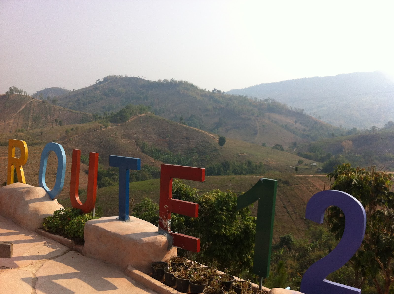
Highway No. 12 (Phitsanulok - Lom Sak) is one of the main access routes. Along it, you can stop and enjoy the view at a coffee shop with tons of Americana trinkets.
Or you can stop a http://www.ilovekhaokho.com/ - a resort squarely aimed at young Bangkokians that come to “experience nature” including a children's zoo where even teenagers seem to enjoy playing with pet farm animals.

Personally, I certainly prefer Khao Kho to Wang Nam Khieo, but it is much further from Bangkok, so getting there requires more effort.

Thursday, February 3, 2011

Phitsanulok - Phu Hin Rong Kla National Park


The park has its name after some unusual rock formations. 50 or 100 million years ago, the Earth’s crust moved and broke into large cleavages. These rock plates cracked open and moved slightly apart.

To approach the park from the east (i.e., from Lomsak) is the best option by far. At least if you like to drive up serpentine roads enjoying wonderful views.
The park area is mainly covered with lush green forests, several awesome waterfalls, and a vast plain of rocks with cracks scattered all around. The highest point of the park is 1,667 meters above sea level.

Like in the rest of the Phitsanulok, Petchabun, and Loei highlands, the weather in the park is relatively cool all year and the rainfall is heavy during the rainy season.

So, Bangkokians like to visit during the cold season, rise early from their tent, and witness the sun rise

The park is located both in Phitsanulok and in Loei provinces. It was an important battlefield in the 1970s fight between the Communist Party of Thailand and the Royal Thai Army.

One of the main rebel bases, complete with a hospital, a rice mill, and a School of Military Tactics were located inside the park.
A brief look at the accommodation at those bases is enough to convince me that communism is not the way forward.

There is a trail leading to Lan Hin Pum, an area of jutting rocks that the CPT used as an air-raid shelter. Follow another trail to Pha Chu Thong, the cliff where a red flag was raised when the CPT gained a victory.

I’m no military expert, so I’m wondering why the communists raised the flag so near their headquarters. The flag must have been a strong indication to the military where they were hiding and an invitation for more attacks.

There were no reliable indications of the number of casualties, but the area earned the nickname “lan leud” (field of blood) as the communists folklore was that a large area had become soaked in the blood of heroic communists.

Sunday, January 30, 2011

Thailand - Dual Pricing Taken to the Extreme

A common complain (from foreigners) in Thailand is that is the policy of charging foreigners more is unfair and even racist. I understand that there are reasons why dual pricing can make sense.

One often heard argument is that foreigners don’t pay income taxes in Thailand so they should therefore pay more (ten times as much as a Thai) to enter national parks or museums, i.e., Thai nationals contribute to running national parks via income taxes. But this is actually an afterthought and not the original reason for introducing dual pricing.


The spirit of the National Parks Act of 1961 assumed that natural and cultural attractions, including sacred and historic sites, nationwide are part of the national heritage, belonging to all Thais equally. So, provisions were designed to ensure fair and equal opportunity for each and every individual Thai to have access to national treasures, and the natural and cultural heritage inherited from their forefathers.

This put a limit on how much entrance fees for Thais could increase, so over time, foreigners were left holding the bag whenever there was a need to plug a hole in the budget for national parks.

Another argument centers on simple microeconomics, i.e. the price of goods and services should be differentiated depending on the marginal utility and price sensitivity of various customer segments. In other words, foreigners are (in general) richer than Thai and can therefore better afford to pay more. This makes sense in a competitive (private sector) industry, but probably not when discussing pricing of public goods.

Good examples of taking dual pricing to the extreme can be found in Chiang Mai Zoo. It is incomprehensible to me why foreigners visiting a zoo must not only pay more in entrance fee and to visit the aquarium, but foreigners also have to pay more to use bus and tram services to get around the zoo. Do foreigners weigh more and thus cause more wear and tear on the equipment?


Another annoying aspect of this overpricing is the attempts to hide it by writing the Thai prices in Thai which few foreigners can read. Hence, they don’t know they’re being cheated and they don’t complain. It’s a bit too clever for my liking.


More importantly, the dual pricing in the private sector is actually illegal.


The legal framework on pricing - for tourism attractions that are wholly-owned, funded, and run by private sector operators - stipulate unequivocally that there can only be one price charged for entrance and that this price but be prominently displayed at the entrance.


This rule is obviously frequently blatantly ignored. If you notice this rule is broken by private sector operators, feel free to complain about unethical pricing practices to the Ministry of Tourism and Sports' Office of Tourism Development on co_service@tourism.go.th


Good luck.

Wednesday, January 26, 2011

Bangkok - The Manhattan Rebellion

An interesting piece of historic fact is that the only large vessel the Royal Thai Navy lost in combat over the last 100 years was sunk by the Royal Thai Air Force on June 30. 1951.


The background was the intense rivalry between the army and the navy since the military coup of November 8, 1947. Over the next four years, three unsuccessful rebellions were used by the army to gradually increase its power and sideline the Seri Thai movement as well as the navy.


After the failed Palace Rebellion of February 26, 1949, several senior navy officers were forced to retire leading the way for younger and more radical officers. The navy had enjoyed royal prestige since its inception as its first commanders were princes of high rank, but the importance and social prestige of the naval officers were now under threat.


On June 29, 1951, Prime Minister Phibun attended ceremonies for the transfer of a US-donated dredge named Manhattan. Naval officers carrying sub-machine guns and rifles walked up the gangway of the Manhattan unobstructed and simply told the PM to go with them. PM Phibun offered no resistance and went with the armed sailors as he was told. He was led off the ship and on to another boat that took them to the Sri Ayutthaya, a navy cruiser docked across the Chao Phraya on the Thonburi side.


The coup makers, calling themselves the Save the Nation Group, informed the public that a coup had taken place through broadcasts from the navy radio. They said it was necessary to overthrow the government, which they accused of being corrupt, undemocratic and incapable of administering the country. The coup makers labeled the government leaders ''big gangsters'' and asked for public support.


The young coup leaders had assumed that with the PM as their hostage, the military junta (known as the Coup Group) of 1947 would give in. They failed to realize that despite Phibun’s popularity in the army, saving him had low priority to the junta compared with its desire to secure the army’s monopoly on power.


The Coup Group rejected the demands outright and fought back with the full support of the Royal Thai Army, the Royal Thai Air Force (formed as recent as 1947 and effectively under the control of the army) and the Royal Thai Police.


All attempts at negotiation failed and the two sides kept up a battle of words over the radio waves all through the night. Fighting broke out in Bangkok before daybreak of June 30 between the armed forces rallied around the government and those supporting the Save the Nation Group.


Rebel marines were able to take over the Wat Leap power plant and nearby telephone exchange, but a combined police and army force took back these strategic sites within a few hours. The air force conducted heavy bombing raids on targets including the coup makers' command centre, the naval dockyard on the Thonburi side and several naval bases. The Sri Ayutthaya flagship was also bombed and sunk. Phibun was saved by naval officers and swam ashore.


Fighting continued, but the Coup Group started to gain the upper hand in the early afternoon and fighting ended in the evening of June 30, 1951.


Both sides suffered heavy casualties. Official figures list 68 dead and about 1,100 injured. Civilians accounted for 44 of the dead and 400 of the injured. Besides the Sri Ayutthaya, the Kamronsin was sunk and many buildings were destroyed in the heavy fighting. The naval dockyard was burned to the ground.


More than 1,000 naval officers and sailors were charged and placed on remand. Most were later released for lack of evidence. About 100 were imprisoned. Many high-ranking naval officers were dismissed from their posts, and the navy lost a great deal of prestige and influence. The navy headquarters was moved from Thonburi to Samutprakarn while the fleet was moved Sattahip in Chonburi to keep them far from the seats of power in Bangkok. The army took over several navy buildings and bases as the navy was downsized to the bare minimum. The naval air contingent was transferred to the air force and the marines were drastically reduced in size.