Friday, December 23, 2011

Chantaburi - Laem Singh

Apart from Chao Lao beach, Chantaburi has many interesting sites to visit near Laem Singh, e.g., a local version of Seaworld, Khuk Khi Kai (chicken shit prison), temples, waterfalls, and a maritime museum. One of the most famous waterfalls is Phliu. The water falls 20 meters and at the foot of the waterfall, there is a pyramid and a statue in memory of King Rama V's beloved queen who drowned in a boating accident on the Chao Phraya River. 
A concrete path leads to the waterfall - passing places where you can feed veggies to gluttonous fish - but there are also nature trails in the area surrounding the waterfall (Phliu National Park).


One the road to Phliu, you can turn right off onto a small road  right. After you reach Wat Khao Ta Nim from where you used to be able to walk 400 meters up a hill to see a precariously balanced huge rock that is shaped like an old Chinese merchant ship. So, the rock is called Hin Sumpao Jeen. But last I was there, they had cut down all the vegetation on the hillside and seemed about to plant rubber trees, so now it may be that you will have to trek across somebody's plantation.
At the mouth of the road leading to Phliu (i.e., on Sukhumvit Road), you can stop and visit Wat Mangkon Buppharam to see a temple in Chinese style architecture. 

Monday, December 19, 2011

Chantaburi - Khao Khitchakut

Khao Khitchakut is one of Thailand's smallest national parks, but has a some wildlife (including barking deer and gaur), nature trails as well as a couple of waterfalls like Khrathing Watefall, which is seen from a distance in this picture. 


However, for two months each year, the park's Phrabat Mountain (just over 1,000 meters tall with a big rock at the top) is the destination for thousands and thousands of pilgrims that converge every day during those two months in order to hike to the summit to pray at Buddha's footprint.
Common wisdom has it that if you can make it to the top, you will be granted a wish. However, now that so many is doing this pilgrimage, hear-say has it that now you have to make at least three pilgrimages before a wish is granted.
As could be expected, this pilgrimage has developed into a major business for the locals. They will charge fees for parking space at the foot of the mountain. You are told you cannot drive yourself and the wonders of monopoly ensures that the locals offering to drive you up can charge an arm and a leg for the 3-4 km ride. After that, then you have to hike for another 3 km to reach the top. 
Since there are so many cramming in on the trail, it is the crowd and not the steepness that limits your progress. So, a round-trip pilgrimage can take 6-10 hours leaving you quite exhausted or at least exasperated when you're finally back at your parked car. 

If you continue further up north towards Sa Kaeo Province, you'll find Soi Dao Wildlife Sanctuary and the16-level Nam Tok Khao Soi Dao. Before that, you can stop near Pong Nam Ron to see a hot spring.

Thursday, December 8, 2011

Bangkok - Father's Day 2011


His Royal Majesty Bhumibol Adulyadej's birthday is December 5th. Each year, Thais celebrate that in a big way, e.g., with boat processions, singing contests, decorative lights on main thoroughfares etc.

For the first time in many many years, access to the Royal Palace Grounds and to Wat Phra Kaew was open during evening hours. Thousands of Bangkokians turned up to enjoy the spectacular sights.

This year, HRM the King turned 84 and thus started a new 7-year cycle.

I took a few snapshots in palace grounds and around Sanam Luang on December 7th. Below is link to my blog from last year.

http://tinamue.blogspot.com/2010/12/bangkok-fathers-day.html

Monday, December 5, 2011

Rayong - Khao Chamao

Khao Chamao and Khao Wong National Park are located in Klaeng District.  3-4 km from entrance to Khao Chamao, you can find the Klong Pla Kang waterfall. It is a lot more impressive and beautiful than Khao Chamao waterfall, but it is also rather difficult to reach. During the rainy season, the access road gets so muddy and slippery that the rangers often don't allow people to enter.


Khao Chamao waterfall is the most famous and visited attraction. Turn off the highway (Sukhumvit Road) at km 274 and continue for around 16 kilometers. The waterfall has seven levels and reaching the top levels requires ascending on a very rocky trail. The rocks can get very slippery during the rainy season, so the rangers often block the trail at level 5.


There are of course various types of trees and plants, but what surprised me was the information that this (relatively) small patch of forest is the last remaining old-growth forest on the Eastern Seaboard.


At the second level (called "Wang Mutcha") there is a pond, which is brimming with fish. They have become icons of this waterfall and it is a must for visitors to feed them.

If you are allowed to enter and park, ahead awaits a sturdy walk through the forest followed by a relatively steep climb up the mountain. Steep and slippery - one rainy day, I fell on the rocks and hurt my back. One of the occasions where an afternoon spent in front of the TV seemed a better option.


If you have the time and the stamina to do the climbs, however, a visit to Khao Chamao national park will reward you with a good feel of exploring a real rain forest where you may run into real "wildlife" like the little bugger pictured to the right. 


After the climbs, there is a wonderful beach about 10 km from Laem Mae Phim (in direction of Ban Phe), which is relatively deserted.   

Saturday, November 26, 2011

Nakhon Ratchasima - Sai Ngam


This public park – named after a nearby village – houses an impressive old tree. Inside the “park”, there is a number of small restaurants, a pond, and a banyan tree. The tree is said to be almost 400 years old, but instead of growing tall and fat, this tree has spent its time spreading out over a large area. According to a sign under the tree, its branches cover an area of 3,500 square feet. Why the sign writer chose to use an American measure of measure is a bit of a mystery, but the equivalent area is 325 square meters.

The pond is artificial as it is actually a small part of the Mun (pronounced moon) River that has been dammed up. That it is a banyan tree that has spread out like this is taken to be important because the Lord Buddha supposedly achieved enlightenment while meditation under the shade of a banyan tree.

The tree has not been promoted much as a tourist destination and is not that well-known even among Thai tourists. Tthe number of signs leading to the park is low and all signs are in Thai. I had not visited the tree for a very long time and passed the park and had to U-turn at the village. In my defense, I’d say that at my previous visits, there was no wall fencing in the tree so this time, I basically ignored the wall.


Anyway, the visit brought back memories of my first trips to Nakhon Ratchasima… to Sai Ngam, Phi Mai, Phi Mai National Museum, Dan Kwian pottery village, Suranaree Technical University, Korat city, and to the WorldTech exhibition. Back then, I was of course younger and was then enlisted to do the obligatory rounds under the belly of the elephant monument downtown.

Back then, construction work at Suranaree Technical University’s campus was only half finished, but classes had started. Today, Suranaree Technical University is in full operation. On campus is the unusual Northeastern Museum of Petrified Wood. Apparently, there are less than ten museums in the world focused on petrified wood, so if that's your thing, it is a must see. 

The museum is in fact well-organized and interesting. A visit is worthwhile. 

Monday, November 21, 2011

Nakhon Ratchasima - Phimai Historical Park


The park is one of the grandest and certainly the most famous Khmer historical site in Thailand. It was one of several sites where pilgrims traveling between the Khmer/Angkor kingdom and India could seek sanctuary.

Despite the Phimai Historical Park being under the same regional head of national parks as Khao Phanom Rung (another famous Khmer sanctuary), the staff at Phimai are more willing to listen to arguments that foreign visitors can enter paying a “Thai” ticket price of 20 baht instead being forced to pay 150 baht.

The Phimai Sanctuary is rectangular in shape, 565 meters wide and 1,030 meters long. It consists of ornately carved structures made of sandstone and laterite. From stone inscriptions and the architectural style, it is surmised that the Phimai Sanctuary was built at the end of the 11th century.

The Naga Bridge is near the park entrance, south of the main pagoda. The intention was for the bridge to represent a link between earth and heaven. The main pagoda is on an open area in a curved walkway. It is the centre of the site and is made entirely of white sandstone and is different from the porches and walls that are made primarily of red sandstone. The pagoda is 28 meters high, has a square base, a portico and stairways and doors in all 4 directions.

The pagoda consists of a base, outer walls, columns, and porches with beautiful designs and lintels. The layout is (of course) like a direct replica of what can be found at Angkor. Of vital importance are the lintels that mostly recount the tale of Ramayana from Hinduism and tales of the Mahayana sect of Buddhism.

Near the historical park is Phimai National Museum. The museum houses exhibits on the past cultural prosperity of the Northeast.

Tuesday, November 15, 2011

Bangkok - Crystal Design Center

I realized I haven't blogged much about Bangkok, the center of the (Thai) universe. There are so many diverse things to do in Bangkok that it doesn't make sense to me to write about it. 


However, I will mention Crystal Design Center. Partly because it was a very trendy place in 2011 -- who knows about 2012? -- and partly because the name is totally misleading to an ignorant person like me. At first, I heard about it as CDC, so I thought of Commonwealth Development Corporation (UK) and Centers for Disease Control (US). Then I thought it would be a center showcasing artsy crystal design.


Alas, Crystal is just a name and doesn't refer to any glass products. And the focus is on selling rather than on being artsy.

CDC is the most comprehensive and integrated Design Center in Southeast Asia showcasing architectural, interior, decorating and construction brand name or "designer" products. Or put it another way, it is a lifestyle home department store for people that want stylish and expensive stuff for the home.


There are more than 500 shops and 10,000 brands across 22 buildings. Ad on top the outdoor market stalls that open up late afternoon and you can easily shop until you drop. 


http://www.crystaldesigncenter.com/


Now, since this is a destination for Thais, there are of course also plenty of food outlets including some very hip pubs, bars, and bistros, such as "WINEILOVEYOU", which in 2011 has been one of the must-visit places for young trendy Bangkokians.


http://wineiloveyou.com/


It is definitely advisable to book a table in advance on weekends and better come before dark falls if you want to easily secure a parking space instead of having to fight to get on. That being said, wineiloveyou was not quite up at par with similar venues (Wine Fusion or Wine Connection) in Bangkok proper (i. e., Thonglor / Ekamai). But I assume wineiloveyou was popular because it was new and because it is located a bit out of town, yet close to an expressway exit.


It may well turn out be be a fad like Mansion 7 in Ratchadapisek Soi 14


http://www.themansion7.com/index.html


This "boutique thriller mall" combined food, fashion, and fear and was the talk of the town for about 7-8 months, but has now slipped into obscurity.

Monday, November 14, 2011

Kanchanaburi - Off the Beaten Track (Part 2)

Since my blog
http://tinamue.blogspot.com/2011/05/kanchanaburi-sangkhlaburi-4wd.html
that contained my opinion about Toyota Fortuner's (relatively) limited off-road capabilities, I have been asked to retract such "derogatory remarks".


So let me elaborate.
I have driven many SUVs and baby-SUVs and clearly vehicles with automatic gearshift and gasoline engines (such as Nissan X-trail and Honda CRV) fail miserably when facing real 4WD challenges like rocky or muddy mountain roads. The same can be said about a Toyota RAV4, but (at least with manual gearshift) it can be driven quite sportily, e.g., doing power slides through sharp turns on gravel roads. 

A Kia Sorento is also a 4WD vehicle, but it doesn't have the feel of a vehicle one would like to take off road. That being said, it's an awesome feeling to have a 3.5 liter gasoline engine rumbling under your foot. The 3.5 liter Mitsubishi Pajero has since 2008 strayed from being an off-road vehicle and is now a full option boulevard cruiser feeling under-powered compared to the Sorento.


Such baby-SUVs cannot hold a candle against rough-and-rumble vehicles like the Mercedes G-Wagon - it drives like a tank (heavy and unstoppable) but you can enjoy the ride in comfy leather seats - or the Toyota Landcruiser. Both, but especially the G-Wagon, are so superior off-road that they almost make such driving boring. 


(Let me add that I have a job situation that allows me to not worry about costs related to car ownership, maintenance, insurance or fuel consumption, and that has provided me with access to use a large number of different vehicles and drive in different countries over the years).


A Fortuner is not a baby-SUV, but a real SUV. That is, it is quite capable of handling relatively rough terrain while at the same time being quite comfortable on the hiway. Especially the version  powered by a 2.7 liter gasoline engine is a good drive on normal roads. Since that is where it's used most by most people, the lack of torque (compared to the 3.0 liter turbodiesel) for off road challenges is not that relevant. However, the increased fuel consumption probably is if one has to pay for what one consumes - something I fortunately don't have to, so I had great fun in the gasoline powered Fortuner also off road.
My points actually are:
* the Fortuner is an SUV, i.e., a multi-purpose vehicle rather than a dedicated off-road vehicle
* a Fortuner is mostly bought by people that use is on public roads, which is why the recently launched 2WD versions have been highly popular
* a Fortuner is a mechanically highly reliable vehicle; the model's initial flaw re weak brakes has been fixed but the suspension is still uncomfortable and far inferior to the Isuzu pick-up
* it is a good Thai product and at par with Toyota Prado models sold in the Middle East and superior to the Prado models sold in Africa.


So, my Fortuner loving friends can calm down. I support the notion that the Fortuner is a great all-round SUV. Join the club:

http://www.fortunerclub.com/main/index.php

Friday, November 11, 2011

Thai Noun Classifiers


Thai is difficult to pronounce correctly, but foreigners are generally pleased that the grammar is so easy. At least, until they really start to learn Thai.

Since I have never attended a language school, I'm not about to teach anybody about Thai language. However, I want to point out the impossibilities of learning Thai noun classifiers as there don't seem to be any rules of how/why. One simply has to memorize the noun classifiers - what is the classifier for that noun. 


The classifier "lem" is used for books, so one book = năng-sŭh-nùng-lêm. But it is also used for notebook, candle, and knife. "Toor" is used for table and cat, while "taeng" is used for pencil and gold bricks, but don't ask why it is so..
If we talk about vehicles in Thai, we have to use different classifiers. Car and bicycle are "khan" (e.g., rót-nùng-khan), but for boats and airplanes, the classifier is "lam". 
Thai noun classifiers for fruits are “phŏn  or “bai or “luuk" however way you please. "Luuk" is used for many round things such as footballs and bowling balls while “bai” is Thai noun classifier for bag, basket, and banknotes.
And so it continues. So, you have to learn and memorize the classifier for each noun as well as learning and memorizing the noun itself.
To make things a little bit more complicated in terms of learning, but a lot more specific in terms of communication finesse, if one wishes to express that one thinks the quantity of the noun discussed is insufficient or too many, then .. add a word to classify the classifier.
For example
káo mii sûa kâe săam dtua   I only have three shirts
dtua is the classifier.  sûa is noun. kâe indicates that I don't think three is a sufficient number of shirts for me to have.

káo gin sôm dtâng yîi-sìp lûuk  I ate 20 oranges (which was too many for me) lûuk= classifier.  sôm is noun. dtâng indicates that 20 was too many for me to eat.

Saturday, November 5, 2011

Buriram - Khao Kradong

Buriram has many attractions.


Khao Phanom Rung is but one of them and it is one that forces foreigners to pay five times what Thais have to pay – yes, the Thai prices are of course written in Thai script to keep unsuspecting foreigners unaware of this racist policy.


So, a less historically significant, but free sight, is Khao Kradong near the provincial capital.


It is a rocky hill that once in prehistoric times was a volcano. Now, a temple, a large Buddha statue, as well as the remnants of the crater are the main attractions.


At the foot of the hill is a small reservoir where families can relax in the shade of trees while youngsters can paddle around.


Saturday, October 29, 2011

Surat Thani - City Pillar

Surat Thani City is located at the mouth of the Tapi River.The city pillar (Srivijaya style) is located on the bank of the river right in the old city center. It is absolutely beautiful.
Since Surat's major agricultural products are rambutan and coconuts, there are several monkey training schools in the province. 


Another "specialty" is bull fighting with stadiums around the province taking turn hosting water buffaloes banging it out.

Wednesday, October 26, 2011

Surat Thani - Chaiya

Chaiya is one of oldest cities in Thailand and is well worth a visit. It was once a thriving center for trade and therefore has plenty of historic sites. Chaiya was a regional capital in the Srivijaya kingdom of the 5th to 13th century - some historians even claim that it was the capital for the kingdom for some time, but this is largely disputed.

More interesting than these disputes is Wat Praborommathatchaiyaratchaworawiham. This temple has an ancient chedi that houses Buddha relics that are highly revered by local residents. The restored Phra Borom That Chaiya is believed to have been built more than 1,200 years ago.

The adjjacent branch of the National Museum has several relicts of that time on display.  

Monday, October 24, 2011

Nakhon Sri Thammarat - Khanom

Khanom Beach is comprised of 3 sandy beaches: Nai Praet, Nai Phlao and Pak Nam. With the hype as usual being the primary means of promotion, this beach is touted as the Riviera of the Gulf of Thailand. Needless to say, this is not true. However, Khanom has managed to become a destination in its own right. Albeit the number of visitors is low, Khanom seems to attract visitors that take a break from Samui.

In my view, especially Nai Phlao isn’t worth a visit unless you are going there to see Khao Wang Thong Cave. If you are going, then check out Suchada Villa, which is a family-owned and family-run resort that offers quality-for-money accommodation. 


http://www.suchadavilla.com/

More interesting, at least in my book, are the beaches in the Sichon district. There, the sand is clean, the beach spacious and un-crowded and the water is clean. The main beach is known as Hua Hin Sichon among the locals. Rocks line the beach all the way to a curved sandy stretch where people can swim. Hin Ngam beach has a unique characteristic in that it is littered with round rocks of various striking colors, hence its name. Kho Khao beach is also a popular beach that connects to Hin Ngam beach.


In the Khanom District, I highly recommend a visit to the Mu Ko Thale Tai National Park. Sure, there is an OK beach to the left when you reach the pier. But do yourself the favor of taking the easy route. Instead, turn right at the pier and take the gravel road that leads you precariously over a ridge and you’ll reach a wonderful and almost desert beach in a small bay.
As the name indicates, the national park is a collection of islands (here viewed from the before-mentioned ridge), so you need to take a boat from the pier to explore those wonderful sights.

Sunday, October 23, 2011

Ranong - Koh Phayam

Koh Phayam is the (relatively) undiscovered pearl of the Andaman Sea with long white sandy beaches, clear blue sea, coral reefs, it's the perfect place to really get away from it all. But based on my personal experience, it is not a place to go during the rainy season

Koh Phayam is only 10 km long and 5 km wide with population around 500 people. Small roads without cars – just motorcycles and bicycle for cruising around. It takes two hours from Ranong to Koh Phayam by boat and 45 minutes by speed boat.

The island‘s two main bays are Aow Yai and Aow Khao Kwai (pictured). If you get bored of the beach life then there's always the inland experience with several good mini hikes into the hills, forests and jungle.
Koh Phayam is 35 km from Ranong city and close to Burmese St. Matthew's Island. Boat service to/from the Ranong Pier is one time per day in low season (May – October) and twice a day in high season (November – April). Speedboat service runs only in high season.
Buffalo Bay is the quieter beach, especially south east part of the bay. More upscale and better quality resorts dedicated to families with kids, groups and middle age pairs. So quiet in fact that I got bored during my stay there and cut my stay on the island short. That gave me time to revisit not only Ranong's hot springs, but also the Ranong Canyon - which turned out to be a small lake. But as they say, it is the journey and not the destination that matters.

Tuesday, October 18, 2011

Ranong


Ranong is famous for its hot springs, the Kra Isthmus viewpoint (at the peninsula's narrowest point of 44 km), and for an easy boat ride to a casino in Myanmar.
Ranong’s hot springs used to be difficult to reach and/or too hot, i.e., you could use them to boil eggs, but not as a spa.  For example, the access road to the Chon Rau hot spring used to be too rocky for a sedan to use due the such vehicles' insufficient ground clearance.

Around 5-6 years ago, roads started to be built and most hot springs are now easily accessible. The Raksawarin springs are now a major draw on weekends. However, I still prefer the hot springs in Kanchanaburi and Krabi.

Visitors to Ranong should go to Laem Son National Park. The beach and pine tree areas are “average”, but the attraction is that on the way to the beach, you’ll pass markers indicating how far inland and how high the sea water reached when the Boxing Day tsunami hit that coast in 2004. If you stop in one of the village shops or restaurants, you might get people to talk about their experiences.

Further south in the province is Phraphat Beach, Which is an awesome place for a family picnic. The beach is long, wide, clean and with very few visitors. If you really want to be alone on a beach, take track that leads to Had Ao Jak on the other side of a hill - the picture shows Had Phraphat seen from that hill.

The drive along the Ranong coast line is scenic and really worthwhile. Moreover, if you enjoy driving on serpentine mountain roads, the drive over the ridge running in the middle of the peninsula will be fun. Either cross into Ranong in the north from Chumpon city or in the south of the province coming from Lang Suan.

Wednesday, October 12, 2011

Prachuap Khiri Khan - Ao Manao


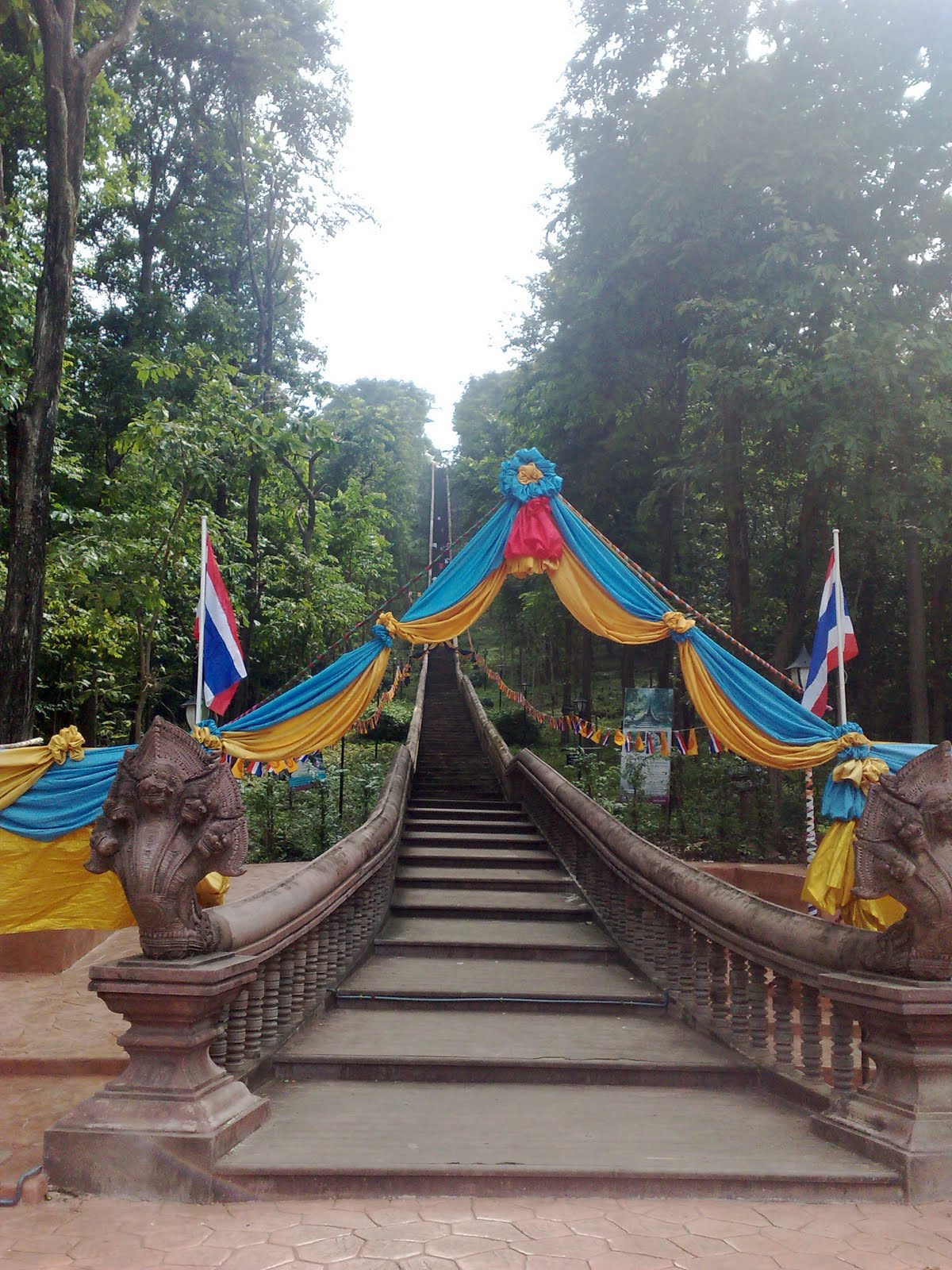
This beautiful semi-circular bay is inside a military base under the care of the Royal Thai Airforce’s Wing 53. Above photo is of a signboard set up next to the beach.


The bay is some 4 km south of Prachuab town center and visitors have to cross a small runway to get to the beach. The beach gets very wide at low tide and is lined with pine trees, so visitors can sit in the shade enjoying good food and fabulous views.

Ao Manao was one of the main points of invasion when the Imperial Japanese Army overran Thailand during the Second World War. But that is not the topic of this blog. Rather, this blog is somewhat retrospective.

Today, Ao Manao is a popular tourist attraction complete with accommodation, shower facilities, and restaurants available for the general public. When I first visited, you’d have to seek permission from senior air force officers on the base in order to be allowed to use one of the then few (but large) bungalows near the beach. The over-night leisure facilities were reserved for military personnel, much like they still are at the Royal Thai Navy’s area / compound east of Sattahip.

Back then, a few students (the active ones) would propose and arrange weekend trips up country for lazy fellow students like me. At least, that’s how it was done at Thammasat University.

Students had to pay 1,000 baht/trip and be ready to get on a mini-van leaving Bangkok Friday evening. The trip organizers would handle all payments during the trip (fuel, food, vehicle rental, accommodation, etc). All expenses would be split equally and we’d would have to top up if there was a deficit.

Each mini-van could carry 10 students and there would normally be 15-20 students joining. Roughly split 50/50 female/male. Leaving Bangkok Friday evening ensured we’d arrive at the destination Saturday morning.

Now, it would have been wise to sleep while being transported, but – alas – it never worked out that way. Invariably, the mini-van would be humming and buzzing with jokes, gossip, idle talk, and innocent flirtations all kept alive with liberal application of Thai whisky (which actually is rum).

After arriving at the destination and checking in, normal people would crash and try to get some sleep. However, on these trips, those annoying active people would drag us lazy bums around to see the local sights. One might then hope for some shut-eye Saturday night, but then somebody would suggest a game of cards combined with more Thai whisky and that would then go on until the wee hours of the morning.
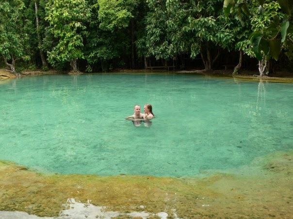
On the way back to Bangkok, the mini-van(s) would stop at various points of interest like waterfalls and famous eateries. In Thailand, no road trip is a success if no good food has been enjoyed and road trips are excellent opportunities to test various local delicacies.


As the van(s) approached Bangkok’s suburbs, the energy levels would drop and finally people started to fall asleep.

Wednesday, October 5, 2011

Ratchaburi - Suan Peung

In a low-key and gradual manner, the Suan Peung district in Ratchaburi has gained great popularity among Bangkokians that love nature and adventure. The area has several challenging off-road routes, natural wonders, and a wonderful mountain climate.

One example of an attraction is a hot spring with mineral water that is believed to be good skin treatment. The water flows all year round from the Tanaosi Range and its temperature ranges between 50-68 degrees Celsius.
However, I was disappointed that entrance as well as usage fees were demanded. The hot springs I have visited in Kanchanaburi and in Krabi were much better.

Before you reach the hot stream, branch off to see Namtok Kao Chon. The waterfall has nine cascades, but water is only plentiful during the late rainy season.

But what I found most amazing in Ratchaburi was Kaeng Som Mao. It is a small valley formed by the torrents of a river and a great place to relax.
Kaeng Som Mao during dry season

Monday, October 3, 2011

Krabi - Koh Lanta

Koh Lanta is a medium-sized island with some very nice and long beaches. As the Ao Nang area got more and more crowded, and as Koh Phi Phi got too commercial, Koh Lanta gained popularity. Back in 2004, real estate developers had started to market the island and plans were hatched to put tarmac on the last strip of dirt road. From 2006, when the tourist arrivals picked up again after having suffered a brief setback due to the tsunami, Koh Lanta had become an important "alternative destination" for tour companies, i.e., crowded, but not as crowded as Phuket, Phi Phi, Ao Nang or Khao Lak.


If you don't seek solitude but don't want too rampant commercialism or in-your-face sex tourism, then Koh Lanta is still a worthwhile holiday destination. However, I prefer to remember it as it once was.

My first visit to Koh Lanta was over 10 years ago -- just after Thai Airways had started domestic flights from Bangkok to Krabi. Back then, access to Krabi's hot spring was free of charge and the Tiger Temple (no live tigers there, but a big rock to climb from where to enjoy the view) was not too crowded. 


And back then, Koh Lanta was still considered a backpacker destination. As roads were considered rough (i.e., unpaved), I was advised not to go there in a sedan. So, a friend of a friend arranged that I borrowed a pick-up truck for the journey from town to island.


That was a great favor so I didn't ask too many questions or check the gifted horse. I was not until I had parked to wait for the ferry that I took a closer look at the truck. And I look twice. It had no license plates nor any registration sticker. 


I immediately called the owner to hear if I missed something. No problem, I was told.  "The Krabi police knows me (and my truck), so I'm never pulled over. If any police tries to make an issue, just call me." Uhm, OK. 


Now, I was already at the ferry so why not continue on to the island. What could possibly go wrong?


And I was wrong. Nothing happened. For three full days, nobody paid any attention to the missing license plates. Meanwhile, I had checked the "credentials" of the vehicle's owner. It turns out that he was the local ringleader for the underground lottery, which explained why he had an "arrangement" with the local police. 


Anyway, sorry for the digression.


I just want to say that Koh Lanta is nice and gets nicer the further south on the island you go, i.e., away from the crowds. 

Thursday, September 29, 2011

Nakhon Sri Thammarat - Khao Luang National Park

Khao Luang National Park covers an area of 570 sq.kms. and the main attractions are waterfalls. I don’t think I need to show more waterfall pictures, but I will say that Karom Waterfall is impressive. It falls 1,300-1,400 height in 19 levels.
In danger of stating the obvious, I just want to point out that driving in national parks during the tropical rain season entails certain risks, As the above picture shows, I found one of the entrance road blocked - the first landslide I encountered, I had managed to drive over, but the second one was a bigger obstacle.

Criss-crossing Nakhon Sri Thammarat's hilly interior on small gravel roads was great fun, but sometimes one has to make  a U-turn even in a 4WD vehicle.. 

I also enjoyed visiting the Kiriwong village, where the ambience is laid-back and with a whiff of being isolated although only a few dozen kilometers from a main highway. There are basic restaurants along a small river, so one can eat while watching the fish (and some kids) play in the stream below.
While driving over one of the ridges just south of the national park, I passed a wall pictured below. Now, why one would want to promote ozone was beyond me. However, the Thai text is actually claiming that this particular location has the best or cleanest air (not ozone) in all of Thailand.

Tuesday, September 27, 2011

Nakhon Sri Thammarat - Wat Phra Mahathat Vihan

Nakhon Sri Thammarat is a very old city by Thai standards as it is more than 1,000 years old and contains many buildings and ruins of historical significance. It was originally located along the coast, wich explains why the city is oriented north-south (i.e., long and narrow).
While the chedi is now in Sri Lankan style, it is said to be built on top of an earlier Srivijaya style chedi. The chedi completed a renovation in early 2009 and now appears like new. Adjoining to the north is the Viharn Kien, which contains a small temple museum.

The chedi is the symbol of the Nakhon Si Thammarat province, present in the seal of the province. It is also displayed on the 25 satang coin.
Wat Phra Mahathat Vihan is the most important temple of Nakhon Si Thammarat and indeed in all of southern Thailand. It was constructed at the time of the founding of the town, and contains a tooth relic of Buddha. The 78 m high chedi (Phra Baromathat) is surrounded by 173 smaller ones.
  
A few years back, there was a frenzy to get hands on amulets from Wat Phra Mahathat Vihan as word spread that owning such an amulet would ensure the owner the winning numbers in the state lottery. Needless to say that soon a mass production of „lucky amulets“ started. For the temple and for middle-men, this was a very lucrative trade for a while. 

Saturday, September 24, 2011

Satun - Thale Ban National Park

Satun is the southernmost on Thailand's west coast, bordered to the south by Malaysia. Satun is one of four Thai provinces with Muslim-majority population.
The province is a must-explore province for beach-lovers - the islands, e.g., Koh Tarutao and Koh Lipe are stunning. However, this blog is about main-land Satun. which turned out to be a big positive surprise for me..

The same-named provincial capital of Satun is a decidedly sleepy affair, but that it its charm.

For example, at the local branch of the National Museum, I was probably the only visitor that afternoon so both (sic!) staff took it upon themselves to give me a guided tour. However, as tourists rarely come to town, the tour was in Thai as the staff wasn't proficient in English.

Satun is mostly mountainous, with plains flattening out the central and coastal areas. The province is also home to Thale Ban National Park, easily visited on motorcycle from the provincial capital.

Bung Thale Ban is a large swamp that is situated in the middle of a valley and surrounded by Chin and Wang Pra mountains. In the mountains, there are several beautiful waterfalls and caves. Communist insurgents are said to have hidden themselves in some of the caves during the 1970s.

The swamp covers an area of 320 square kilometers and is full of freshwater fish and shells. There is an abundance of Bakong trees around the swamp.
Nearby is the almost never-used Wang Prajan border post for crossing into Malaysia.

Wednesday, September 21, 2011

Surat Thani - Khao Sok National Park

This park has virgin rainforest dotted by limestone mountain ranges and a big reservoir in the middle. What attracted me to visit is that Khao Sok is said to be inhabited by plenty of rare wildlife such as wild elephants and tigers, but of course, I didn’t encounter any on my two visits.

What I did experience was a jungle trek and a quite amazing tour of a horseshoe shaped cave. You entered following a creek into a cave. As the cave narrows, you carry on in the darkness. As the cave narrows to only a few dozen centimeters, the water depth increases. You empty your pockets to carry the contents above your head and squeeze on nudged by the guide. Suddenly, it widens again and as you exit the cave, you realize that the cave exit is less than 100 meters from the cave entrance.

This cave tour was shut down by authorities a few years back after a flash flood killed a few tourists.
What I also tried was to stay at one of the first resorts that offered tree-top accommodation. I stayed in a wooden “house” built on tree branches stretching out over a creek.
Seemed a good idea at the time. But to sleep in a tree top over water during the rainy season … well, let me just say that it was a very humid experience.

Sunday, September 18, 2011

Satun - Mountain Life


Satun is mostly known for its islands, but there are also things to see away from the Andaman Sea.

If you take the time to explore along the mountain range, you'll find numerous waterfalls, a hot spring and more rice fields than I've seen in Krabi, Trang, Phattalung or other southern provinces. Satun also has some of Thailand's largest caves.

And in Satun city, there is a famous mosque as well as very interesting branch of the National Museum.

Thursday, September 15, 2011

Krabi - Sea, sun, and white sand.

Koh Lanta was very charming. However, soon after Thai Airways started with direct flights to Krabi, the tourist arrivals went up at an alarming speed. And especially so after somebody decided to put tarmac on Koh Lanta’s main road.


I liked it more 10 years ago when one needed to drive a pick-up to reach the wonderful beaches on the middle and southern portions of the island.


The most beautiful beaches in Krabi are the ones reached from Ao Nang by long-tail boat, but nowadays these beaches can get quite crowded in the high season.


It is amazing to ponder that 20 years ago, mainland Krabi was not a part of anybody’s itinerary. Backpackers complained bitterly if they missed the ferry to Koh Phi Phi and had to spend a night in boring Ao Nang.


For years now, McDonald’s, Irish pubs, and bar beers are among what Ao Nang has to offer. Today, there are probably more tailors in Ao Nang than on Saville Row. These tailors – although born in Burma – speak Swedish to entice Scandinavian sun-seekers to buy suits made in nearby sweatshops.


Long live mass tourism.
One reason I'm annoyed is of course also that there in the good old days weren't entry fees for going to places like the hot spring and the Emerald Pond. Now, these destinations have become national park areas and entry fees are charged. 

Sunday, September 11, 2011

Trang - Town

Situated along the Andaman coast, Trang province features a spectacular karst dotted coastline, a string of islands ideal for sun-seekers, and a forested interior.

The islands of Trang have developed into an ideal alternative destination for those who want an island getaway but don't want to share it with 10,000 others.

The region is famous for being home to a large population of dugongs, the Indian Ocean cousin of the manatees. Like manatees, they're docile animals that spend most of their day grazing at beds of sea grass. They're increasingly rare in the wild, with the sea near Koh Libong being one of the best places to see them in the Thailand.

Dugong has been adopted as a symbol of the province, and appears on everything from the official Trang seal, to boxes of local Trang cake.

The eponymous provincial capital is an old seaport, and echoes of a lingering history can be seen in the crumbling wooden houses that dot its avenues. It's a laidback place, where architectural development seems to have stopped in the 1970s, and the town's taxi fleet (Toyota Crowns and Datsuns) also appear to mostly have been procured during that decade.

But the increasing number of tourist have resulted in development and upgrades. So where I used to enjoy sipping the local coffee at a kopi shop, these small charming shops have increasingly been replaced with modern places more palatable to the taste of Western tourists.

Wednesday, September 7, 2011

Trang - Nature

A drive out of town or away from Pak Meng is highly recommended.

You should go to the Khao Luang and Banthat mountain ranges where you will find plenty of water falls (such as Prai Sa Wan pictured in this blog), caves, trekking trails and relaxation.

There is also a botanical garden and as well as Khlong Lan Chan "non-hunting area", which is very tranquil and perfect for a picnic on the banks of a picturesque lake.

Of personal interest, I know that the Nature Adventure of Southern Thailand some years arranges a 4WD challenge.

It is an off-road "race" for members of off-road racing clubs in Thailand and from foreign countries, such as Malaysia, Singapore, Indonesia, etc., normally with more than 100 cars participating.

Lastly, Trang has a museum proudly showing the history of rubber in Thailand.

Trang was the first Thai province where rubber trees were planted. Governor Phraya Ratsadanupradit Mahison Phakdi brought rubber from Malaysia and planted it here before anywhere else in southern Thailand in 1899.