Wednesday, April 11, 2012

Phang Nga - Boxing Day Tsunami

Today, a 10 cm high tsunami hit Thailand's Andaman coast. How a 10 cm tsunami is distinguishable from a 10 cm high normal wave I don't know. But I know that the Boxing Day tsunami waves were easy to spot.

At that faithful day in 2004, I was at Ao Nang, Krabi. Due to a stroke of luck, I was half an hour late for an appointment to go on a day tour in sea-kayaks.

As I was rushing down the hill to get to the meeting point at the beach, people were running up the hill. When I came down to the beach, I saw people walking around in a daze. The beach road was wet and filled with debris from shattered long tails boats and washed out shops.
Is that a tsunami out there?
That was in Ao Nang where the three tsunami waves were relatively small – crests of only 2-3 meters - compared to the waves that hit Khao Lak, Phang Nga.

The photos in this blog were shot at the Khao Lak beach called Bang Niang. The interesting thing is the similarities between these photos and what I heard / saw in Ao Nang.

At first. people see the water recede, but don’t think much about it. Some even follow the receding water.
Then there is a wave coming, but again people don’t pay much attention – probably because the water/shore line is now so far away. Then the wave comes closer - it doesn't look tall, but it does look more “violent” and powerful than the normal waves.
Hmm, that wave is bigger than it looked
Then as the wave roars towards the beach, people suddenly realize that it is not a good idea to stand around like a dummy. But in Khao Lak, most people realized this too late and didn’t get off the beach alive.

The tsunami wave on these photos looks deceptively small; it was the first of three waves. As I remember from Ao Nang, the third wave was the largest.
Notice the two navy patrol vessels in the photo above. The largest of these vessels ended up three kilometers inland at the foot of the hills, i.e., basically at the furthest point the waves reached.
Tsunami waters flood Khao Lak
The whole Bang Niang are was flattened as water height reached six meters. Many of the small family-owned resorts were not insured. The owners either drowned or survived but were unable to repay their bank loans and big business subsequently moved in.

The last photo was taken two weeks after the tsunami and shows what was left - basically nothing. The place was rebuilt (still called Chong Fah Resort) by the original owners.
In the Khao Lak area, I used to stay near Laem Pakarang at a family-owned resort (Pakarang Beach Cottage) and enjoyed the wonderful beach and personal service. However, this family were among the victims. After the tsunami, a Best Western holiday complex totally dominates Pakarang beach. The charm is gone.

Cambodia - Angkor Wat

After putting it off for years - due to expectations of extreme commercialism - I finally made my way to Siem Reap and to the temples of Angkor. 

While the town's backpacker center was glitzy and fake, it was somehow not as bad as I had expected and certainly not as bad as Bangkok's Khao San Road or as in Luang Prabang. And the temple complex is indeed impressive although it gets "busy" at some places.

So, I'm glad I made the trip although I most probably will not bother going there again. In two full days, you can rush through the sites with some advance planning, but if you have the time, I suggest that you allocate three days.

The southern gate of Angkor Thom (which means Great City) is one of the most famous sights. The bridge crossing the moat is flanked by 54 demons (asuras, on the right) and 54 gods engaged in an epic tug of war as they are pulling a giant seven-headed naga. They're probably churning the Sea of Milk.

This is part of the Hindu creation myth where the gods and demons cooperate for 1,000 years by alternately pulling a giant naga (Vasuki) coiled around Mount Mandara to produce the elixir of immortality. As in real life, once the objective is achieved, one partner to the deal cheats the other. In this myth, the gods refuse to share the elixir with their partners (the asuras) who then try to steal the elixir.

It makes me wonder, if you cannot trust Hindu gods, who can you trust?


Bayon looks like a pile of rubble from the distance but actually has bas-reliefs more impressive than those of Angkor Wat. Bayon has three levels and on the first level alone, the bas-reliefs stretch for 1,200 meters.

The Ta Phrohm temple is very interesting because the temple has (almost) been left in the same state as it was when it was "found" by the French around 150 years ago. This means that the jungle has only been partially cleared; in particular, several large trees have been left standing such as the silk cotton tree in the picture below.

The last picture is from Angkor Wat and is basically only chosen because the sky was so wonderfully clear and blue that day.

Wednesday, April 4, 2012

Cambodia - Sihanoukville

Sihanoukville Railway Station is an icon of shitty 1960s concrete architecture.
In 1955, a construction team arrived at what was then known as Kompong Som to begin work on Cambodia's first (and only) deep water port. When the port was finished in 1960, the area was renamed Sihanoukville in honor of then King Sihanouk. 

Today, with a good road from Phnom Penh, Sihanoukville is drawing a steady and growing stream of backpackers along with expatriates and locals coming down from Phnom Penh for lazy weekends. Russian tourists have also started arriving in droves.

The first time I visited Sihanoukville (over 10 years ago), I loved it; there were kilometers of white sandy beaches devoid of humans. In particular, Otres Beach was totally undeveloped as it could only be reached by motorcycle as there was no road (only a narrow dirt track) leading to the beach.

Now, seediness kinda starts to outshine the prettiness, especially at Weather Station and Victory Beach. The impacts of sex tourists and Russians with ill-gotten wealth flooding in cannot be hidden. Nor can the forces of "development".

For example the once abandoned Independence Hotel has had a makeover while a large portion of the previously public beach nearby was "sold" to a wealthy Khmer with, you guessed it, connections in the local government.


The trend is in the wrong direction, but outside town, one can still enjoy the sights of rice farmers and salt fields or go trekking in Ream National Park.

Sunday, March 25, 2012

Laos - Viengxay Caves


Access to one of the most secret sites from the Vietnam War era was allowed in 2008. The caves at Viengxay, in north-eastern Laos, once hosted the country's communist revolutionaries as they plotted the final US defeat in Indochina. Even now. it takes more than a day to drive to Viengxay from either Vientiane or from Luang Prabang.

During the secret war in Laos it was almost impossible to access that area. The remoteness of this "hidden valley" was one reason that the communist Pathet Lao chose it as its headquarters. The other was that the valley is full of natural caves - nearly 500 of them.

Per head of population, Laos remains the most heavily bombed country ever. In a nine-year-long undeclared war the US dropped half a ton of bombs for every inhabitant. It was a desperate attempt to prevent the North Vietnamese communist forces using Laos to supply their forces in South Vietnam and to prevent the Lao communists taking over the country.

At one point, there were around 23,000 people living in the caves. And the community had everything from factories to make uniforms, to hospitals, to rooms in which the war was planned.

Not all the caves are open to the public, but it is possible to visit the leaders' caves and some of the other more significant places - such as the theater cave where visiting song and dance troupes from friendly socialist countries came to entertain the revolutionaries. 


Conditions were basic at best, even for the senior leadership. The Communist Party bosses - the politburo - lived on camp beds in one room, while the leader of the party, Kaysone Phomvihane, had slightly more spacious accommodation through a tunnel which he shared with his children.

After the war, the area remained off-limits to foreigners because it was used to "re-educate" senior officers of the former anti-communist army.

Laos is the poorest country in South-East Asia, and the caves are in the poorest region of Laos. The local community, hopes that by opening up the former "secret city" of Viengxay to travelers, the area will have a chance to benefit from what, until now, has been an unhappy legacy. 


I wish them the best of luck as I love to visit "adventure destinations" like this one. 

Saturday, March 17, 2012

Thailand - Love Me Long Time


A really authentic and honest "documentary.. 
Especially Nit (the Thai woman - obviously from Isan - interviewed on the beach) provides interesting and seemingly honest "background info".


It's filmed in Lamai (Koh Samui) and Had Rin (Koh Phang Ngan). I cannot recognize Had Rin. When I was there (which year that was shall remain undisclosed), there was no electricity and almost no people. Backpakers stayed in simple huts, played guitar around bon fires on beach, and chilled.

I'm always surprised how foolish Western men becomes in Thailand. They fall in love without understanding the socio-cultural and economic background of the women. They think they are loved back ... fools !


The Thai intro-song is an old (1995) hit .. one of my all-time favorites. It is  a very romantic song about how difficult it is meeting the right man and now that she's finally found him, she's telling him how much she loves him .. .sung by Tata Young (a British father, Isan mother). 

Sunday, March 11, 2012

Laos - Champasak (Si Phan Don)

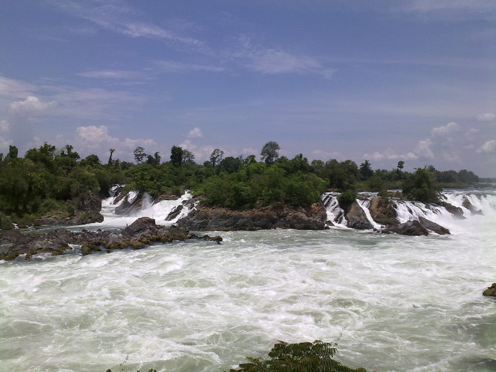
The Khone Falls are the largest in Southeast Asia - the highest falls reach to 21 meters. These falls are the reason that the Mekong is not fully navigable from Viet Nam to China
Because of the falls, the French colonialists could not send gun boats and supplies by river from Saigon up to Vientiane and Luang Prabang. Likewise, they could not get agricultural products exported from Laos by using Mekong. So, they came up with the white elephant project of building a single-track railway between Don Det and Don Khon. It was a temporary railway from 1893, but became longer (seven kilometers in total). and stronger (i. e., permanent tracks, real locomotive) in 1897. 


The last train probably traveled the tracks in 1940 when Japanese troops took over from the French colonial masters. It was the first and only railway ever built, opened and operated in Laos until 2009. 
The area upstream from the falls is characterized by thousands of islands and countless waterways, giving the area its name Si Phan Don or '4,000 islands'. Half of these are submerged when the Mekong River is high at the end of a rainy season. The principal islands of Si Phan Don are Don Khong, Don Det, and Don Khon.   
Freshwater (Irrawaddy) dolphins can sometimes be seen near the southern tip of Don Khon looking towards Cambodia. 


From Don Khon, you can also see the Liphee Waterfall, which is very powerful at the end of the rainy season. Unfortunately, this picture is from my second visit, which was at the end of the dry season. 

Tuesday, March 6, 2012

Laos - Champasak (Vat Phou)

Champasak province can be reached from Thailand through the Chong Mek (Thailand) Vang Tao (Lao) border crossing. From Vang Tao, the road leads east towards the city of Pakxe, the province’s largest city. 

Champasak has a long history that begins with participation in the Funan and Chenla empires between the 1st and 9th century AD. Between the 10th and 13th century, Champasak became a part of the Angkor Empire. 

Following a gradual decline since the 15th century, it was enfolded into the Lan Xang kingdom but then broke away to become an independent kingdom. The short-lived Champasak kingdom had only three monarchs: Soi Sisamut (1713-37), Sainyakuman (1737-91) and finally Fai Na (1791-1811).

Vat Phou (Wat Phu if transliterated according to Thai rules) was a part of the Khmer (Angkor) empire in the early 10th century. At its height the temple and nearby city formed the most important economic and political center in the region.

The Vat Phou temple complex was designed as a worldly imitation of heaven and fitted into a larger plan that included a network of roads, cities, settlements and other temples across present-day Cambodia, Laos, and Thailand. 

Wat Phu is located on the slopes of the Phu Pasak mountain range and it is quite a climb (the steps are steep) to get up to the sanctuary. From up there, however, the view back down makes the climb well worth-while. 
The temple ruins now seen are the product of centuries of building, rebuilding, alteration and addition, with the most recent structures dating from the 11th century. Minor changes were made during the following two centuries, before the temple was converted to Theravada Buddhist use.
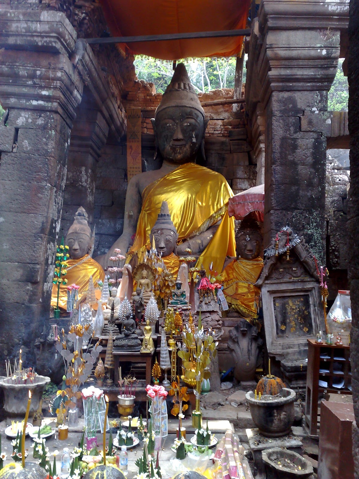
From the cliff wall, water flows from a natural spring some 60 meters to the left of the sanctuary. This water was once led into the temple to continuously bathe the Shiva-linga. Now, people pray to a Buddha statue. 

The spring water is said to have magic / healing properties and people come to carry it away by the bottle. I also dutifully filled a bottle, but it magically disappeared soon thereafter, so I cannot confirm the water's healing properties.