Showing posts with label waterfall. Show all posts

Saturday, February 28, 2015

Prachuab Khiri Khan - Ban Krut

South of Bang Saphan - Chumphon in the distance

http://tinamue.blogspot.com/2013/12/prachuab-khiri-khan-bang-saphan.html

Ban Krut is 65 km south of Prachuab's provincial capital. It is a great oasis for people loving deserted beaches albeit it gets busy on long weekends. The small town has a train station, but most visitors reach it by car. The town's main attraction - apart from beaches - is a big Buddha overlooking the town, but activities, such as building figures (rather than castles) in the sand are also arranged to keep visitors coming.
Angry Sand Birds
The Huay Yang National Park is nearby. It is named after a seven-tier waterfall, which also gets many visitors on long weekends. These are mostly locals going to cool off and play around. In the dry season, there is not much water to play around in.
Huay Yang Waterfall
The national park also have trekking trails and - reportedly - you can cross into Myanmar after 5-6 hours on foot depending on your stamina and agility.

To me, what is so attractive and interesting about Prachuab and Chumphon provinces is that there are long stretches of deserted and undeveloped beach. There are so many places where one can pull over, set up a hammock, lay down a mat, and have a picnic. Some of the beaches may appear untidy to people that are used to beaches being "combed" by resort owners. However, flotsam and other stuff left behind by high tides or storms are part of nature.
Beach Au Natural

Monday, August 25, 2014

Kanchanaburi - Srinakarin Reservoir

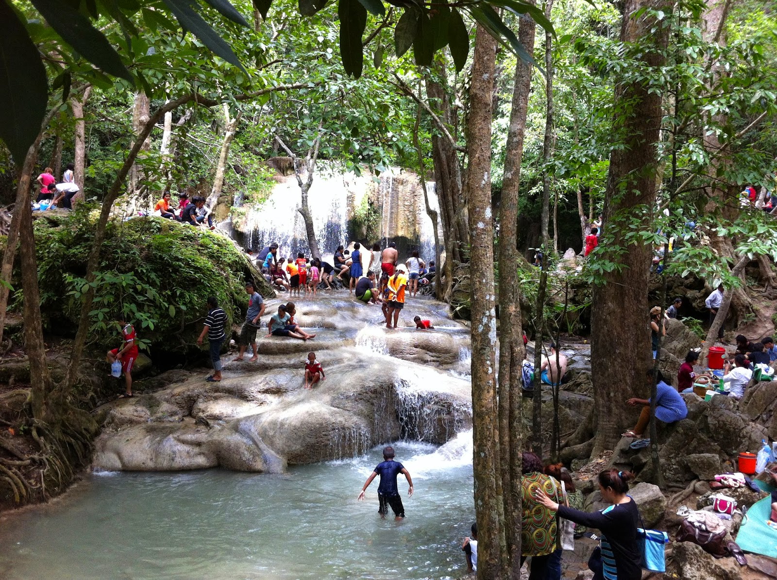
Even on rainy weekends, Kanchanburi is worth a visit. It has been years since my last visit to the 7-tiered Erawan waterfalls and they are now a very busy tourist destination. Locals and foreigners play around in the cool water or lounge on the shores of the stream.  The falls are beautiful, but the atmosphere is not quiet and serene. The sheer number of people makes it difficult to get a feeling of "being one with nature." 
Erawan Falls and plenty of visitors
 So, I decided to head to Huay Mae Khamin Wateralls. Again.


On the way, I stopped at Pra That Cave. It was is quite a climb to get to the cave entrance. The path was well laid out, but the jungle humidity during rainy season made the climb a sweaty one. 

At the cave entrance, a park ranger waited and gave a guided tour once at least four visitors had arrived. Inside the cave were the usual stalactites and stalagmites, but I was surprised by the size of the cave. It is made up of four big rooms and is much bigger than I had expected. 

Next on the agenda was the Huay Mae Khamin Waterfalls - the upper tiers could only be reached if you were willing to risk being totally covered in mud as the paths along the stream had turned extremely slippery due to rain. So, I decided to only enjoy the lower tiers and the view of the Sri Nakharin reservoir. 
Beautiful Huay Mae Khamin 
In fact, I decided to catch a ferry to Si Sawat across the reservoir. Getting from the waterfall to the ferry is bumpy and a bit risky for sedans during the rainy season. The ferries plying this route can best be described as minimalistic, but they do serve their purpose and the trip offers good views. 
Two Rainbows Don't Make a Crowd
As we were crossing, dark clouds came towards us and soon we were drenched. But then, the rain stopped as abrupt as it had started and two rainbows appeared.

Once on the other side, one can drive along the edge of the reservoir - a winding and scenic route - or take another ferry which cuts an hour off the travel time to reach Kanchanaburi city.


Friday, August 15, 2014

Uthai Thani - Cyber Waterfall

This waterfall has alternative spellings. I am not sure why "Cyber" seems to be the spelling most frequently used on the Net as it seems very "un-Thai" to me. At the park ranger station, there is a sign offering a much more correct transliteration.
You can call me Cyber
Anyway, the waterfall is located in the Huai Kha Khaeng wildlife sanctuary. One can park near the ranger station and must then trek roughly three kilometers in lush forest before reaching the waterfall.
Sai Bor is actually not an impressive waterfall, but it is a case of "it is not the destination, but the journey" as the trek provides views and sights that make it worthwhile.

More information can be found at:

http://www.huaikhakhaeng.net/

Tuesday, August 5, 2014

Uthai Thani - Thung Yai Naresuan – Huai Kha Khaeng Wildlife Sanctuary

The Thung Yai Naresuan – Huai Kha Khaeng Wildlife Sanctuary was registered as a World Heritage Site by UNESCO in December 1991.

http://whc.unesco.org/en/list/591

It covers 5,775 square kilometers across three provinces: Uthai Thani, Kanchanaburi; and Tak. It is the largest connected conserved forest in Thailand and the South East Asia Region. To me, the important aspects of this national park is that it really is a sanctuary for wildlife (public access is more restricted than in normal national parks) and that it is so solely due to the work and sacrifice of one individual.

Visitors to the wildlife sanctuary are restricted to three relatively small areas. There are nature study routes (trekking) where one can enjoy flora and fauna. The national park area is so huge that one can only get to experience a tiny part of it. Today, it is a popular destination for groups of off-road enthusiasts who don't come to appreciate nature but to tear through the forest in their 4x4.

At the headquarters of the wildlife sanctuary, there is a statue of Seub Nakhasathien, the man who valiantly fought to preserve what remained of Thailand's forests. He was head of the sanctuary for eight months until he was overcome with despair over the obstacles he faced.

Seub Nakhasathien
 He is quoted as having said: "Personally, I'd rather do conservation research than focus entirely on trying to catch poachers and loggers. The people we catch in the forest are just the workers, not the masterminds. Those who are really responsible, the influential people who arrange and gain all the benefits from the illegal forest activity are never caught. The legal process doesn't apply to them."

For more info on this amazing person:  http://www.seub.or.th/

Near the headquarters, there is a memorial for the park rangers that have been killed while patrolling the wildlife sanctuary. Like khun Seub, these rangers paid the ultimate price in the fight against poaching and illegal logging.

Saturday, July 19, 2014

Nong Khai - Si Chiang Mai

Sala Keo Kou is at the provincial capital

http://tinamue.blogspot.com/2013/02/nongkhai-sala-keo-kou.html
Water is not falling
I went 80+ km to the west of Sala Keo Kou to explore a couple of waterfalls - Tan Tip & Tan Thong or Than Thip & Than Thong depending on how you transliterate their Thai names into English. However, since my visit was during the dry season, there was almost no water, so that was a waste of time.
Mekong at Hin Mak Peng
However, Si Chiang Mai is nearby - roughly 65 km to the west of Nong Khai city. The town is located on the banks of Mekong, just opposite Vientiane, the capital of Lao PDR. Its name is derived from Chiang Mai as the Lan Xiang king that founded Si Chiang Mai had a grandmother who was queen of Chiang Mai.
Vientiane at night
That origin of the name is rather irrelevant today, but the location gives for some great nighttime views across the river of Vientiane's lights. So, it is very nice to have dinner at one of the many basic restaurants along the river.
Chedi with the remains of Luangphu Thet
A once famous temple is located bit west of Si Chiang Mai. Wat Hin Mak Peng became the permanent base of Ajarn Thet Thetrangsi from 1977. Before that, he had been a "homeless monk" wandering through the rural areas of Thailand. At that time, Wat Hin Mak Peng was at a very remote location, but Luangphu Thet gained a large following as a master of meditation and teacher in the "forest tradition" (khammatthana) of Theravada Buddhism. He gained such a reputation that he on several occasions were visited by members of the Thai royal family, including by HRH King Bhumibol. Luangphu Thet died in 1994, but the temple is worth a visit. The temple grounds are large and with plenty of trees to provide shade and the temple area is adjacent to the Mekong River.
Wat Hin Mak Peng seen from the river
The Mekong River is in itself an attraction. Nong Khai being so far away from the sea, the river banks serve as beaches and locals also engage in fishing.
In the photo, the guys in blue and orange shirts are holding the two ends of a net they've dragged out into and along the river. They are now about to bring the ends together onshore to collect their catch.

Sunday, May 25, 2014

Chantaburi - a multitude of options

Chantaburi has something for everyone. The province has great beaches, highlands with waterfalls and hot springs, remnants of gem mines as well several destinations for history buffs. In a temple in the city center, Buddha statues are kept in a building with a roof shaped like the helmet worn by the great Taksin who won Siam back from the Burmese.
Chantaburi was from where the general (later king) gathered his forces, built his fleet, and subsequently launched his attack on the Burmese. Later, Siam came under pressure from the expansionist French that didn't think French Indochina was quite large enough. French troops therefore marched up the coast from today's China and didn't stop until they reached Chantaburi. 
French-built "Chicken-shit Prison"
They occupied the territory until the king of Siam gave two of "his" Cambodian provinces to the French. The French combined incarceration of Thai prisoners with farming - there is a structure near Laem Singh, which used to have prisoners on the ground floor while the top floor was a chicken coop. Due to gravity, the prisoner were "showered" in chicken droppings, which they obviously saw as a great insult.

Beach destinations include Laem Singh and Hat Chao Lao (with Laem Sadet)

http://tinamue.blogspot.com/2011/12/chantaburi-laem-singh.html


http://tinamue.blogspot.com/2010/02/chantanaburi-chao-lao.html

The road from Chantaburi city to Sa Kaeo city goes parallel to the Thai border with Cambodia and there are a couple of small "border markets" and lots of waterfalls along the way. The key destination in that area is Soi Dao.
Rolling hills near Soi Dao

Wednesday, February 5, 2014

Phrae - Mountains

Apart from Phae Muang Phi and temples, Phrae is of course famous in Thailand for its mountainous topography and cold winter nights. During the cold season, especially over the New Year holidays, many Thais from the central and coastal regions travel north to experience cold weather as temperatures can drop to around 10 degrees Centigrade. To them, it is a bliss to freeze a bit next to a mountain stream, so for resorts and hotels up north, the cold season is the high season.
Home Stay Mountain Style
I am not sure whether 1,000 meter peaks meet the international standard for mountains (or whether any such standard exists), but towards the borders with Uttaradit and Nan, Phrae has lush mountains with great views and plenty of waterfalls to explore.
Choeng Thong Waterfall
I have seen too many waterfalls to be excited about seeing one more or one less. I have a tendency to seek out the less-traveled roads although they often are not short cuts. In the mountains, there were several of these roads that went winding on forever without taking me anywhere.
Why should we get outta the way?


Monday, October 7, 2013

Laos - Bajieng Resort

In Champassak province, the heights of the Bolaven Plateau are just east of the Mekong River. The area has numerous waterfalls and coffee plantations.
Green coffee beans
There is also a “cultural theme park”, which has become a hit among Thais traveling on guided tours. If you happen to be in the neighborhood, it is worth a visit.

The “cultural theme park” is actually named Bajieng Resort. The resort opened in December 2003. A Thai national, Wimol Kijbamrung, had worked hard for five years to turn a large undeveloped tract of land into a resort with nature and culture as the its underlying themes. However, one week after the official opening, Khun Wimol came down with a serious bout of malaria and lost his eyesight.
Tad Pha Suam Waterfall
Inside the resort area, there is a stunning waterfall (Tad Pha Suam) with a couple of bridges crossing the river downstream thus creating good spots for taking photos. “Original” houses from different tribes have been erected plus people have been hired to dress up in “original” ethnic outfits, play instruments, play children’s games, weave or whatever so as to create an impression of being in a real rural village. 
It is of course fake, but it seems less fake, less commercial than what can be experienced at assorted hill tribe (long-neck etc) villages in Thailand. The park’s restaurants are quite good and since part of the revenues supposedly goes to support local tribes, one should accept the falseness and consider it “edutainment”. 
Sabaidee

Sunday, September 15, 2013

Ratchaburi - Suan Pheung Update

Things move ahead in Suan Pheung district

http://tinamue.blogspot.com/2013/04/ratchaburi-suan-pheung.html

Since my last visit, they have got far along in the process of expanding the road connecting the provincial capital (Ratchaburi) with the discrict "capital" (Suan Pheung). The number of resorts, coffee shops, and fake sheep farms keep increasing. Note: the sheep are not fake, but the farming is - the sheep are there to allow Bangkokians to come in close contact with cute "nature".

When I visited, the hot spring was crowded with people from Bangkok, but Kaeng Som Maew was not. It seemed only locals were picnicking there and enjoying the rapids. However, there was some screaming when a snake decided to also take a swim in the midst of people enjoying themselves.
Kaeng Som Maew in rainy season
Another relatively undisturbed destination was a seemingly Hindu (or at least Indian) inspired temple. Instead of a Buddha statue, there was a large guy with an elephant's head.
A rather cute concept was that there were two over-sized rat statues ready to grant wishes. One had to whisper the request into one rat ear, while covering the other rat ear (to keep the wish a secret), and the rat would then consider granting the request.
Tell me your dreams

I must not have passed muster because I have not yet won in the lottery.


Sunday, August 25, 2013

Kanchanaburi - Huay Mae Kamin Waterfall

There are too many waterfall in Kanchanaburi to mention them all. Some are stunning (like the Erawan falls), while others are merely interesting.

Huay Mae Kamin was a present surprise at the end of an adventurous journey
Huay Mae Kamin Waterfall Level 4
After I had to interrupt an earlier adventure due to lack of fuel

http://tinamue.blogspot.com/2010/03/kanchanaburi-off-beaten-track.html

I this time filled my tank in advance and before again attempting to drive back from Thong Pha Phum along the western fringe of the reservoir behind the Sri Nakharin dam. It worked out well and it was a nice off road experience that by coincidence brought me to the Huay Mae Kamin waterfall.

Of course, everybody else at the waterfall had come the easy way - entered the Khuean Srinagarindra National Park from the south.

Thursday, June 20, 2013

Chaiyphum - Tat Ton Waterfall

Tat Ton National Park is a scenic little spot on the edge of the Laenkha mountain range, 23 km north of the city. Covering 218 sq km, Tat Ton is best known for its photogenic namesake waterfall. Tat Ton waterfall is only 6 meters tall, but stretches to 50 meters in width during the May to October rainy season.
It is a great picnic destination for families and it is among Chaiyaphum's most famous nature destinations.   Rustic bungalows are available riverside, but the English version of the sign leading to the national park's store is a bit mystifying. Major benefits apparently include souvenirs, trinkets, snacks, and cold drinks.

Saturday, May 25, 2013

Nakhon Nayok - Waterfalls

Nakhon Nayok is a major weekend destination for Bangkokian nature lovers. The province has several waterfalls to visit and plenty of resorts scattered around lush hill sides. Some of the national parks that commonly but incorrectly are referred to by Bangkokians as “Khao Yai” protrude into the northern parts of Nakhon Nayok.
One of the famous waterfalls is Nangrong. It is not a tall or otherwise impressive waterfall, but it is a  very popular destination. It is so, probably because it offers plenty of opportunity for people to settle down for picnic and splash around in the river.
 Another famous waterfall is Sarika, which is located inside a national park. It is a tall waterfall with water flowing in a narrow rapid stream. There are a few places for visitors to splash around, but yet it is a relatively popular destination. The reason why it is famous / popular is probably that the waterfall has an impressive nine levels that combined make a drop of 200 meters from top to bottom.

Near Nangrong, a small detour can take you to the Khlong Tha Dan Dam, which is also referred to as Khun Dan Prakan Chon Dam It is not an especially high or imposing dam, but it is reportedly the largest dam in Thailand based on the number of cubic meters of cement (actually, compacted concrete) used to build the dam.
From the top of the dam, you can take in the view of the valley below and all the way into town. The reservoir behind the dam is woefully underutilized – no boat trips are on offer and no kayaks can be rented. One reason may be that the dam is relatively new (2005) and the tourism industry has not yet put boat trips on the agenda for tours to Nakhon Nayok. 

Saturday, February 2, 2013

Surat Thani - Koh Samui


Bangkok, Koh Samui, and Koh Phangan were my destinations the first time I visited Thailand. Back then- before the airport on Samui opened for commercial flights – things were very different from now. Back then, backpackers and sex addicts were just about the only tourists making it to Thailand and sex tourists didn't venture outside Bangkok.

I remember Bhoput as a tiny sleepy fishing village with a few restaurants – one also served as post office and as a place where one could cash in travelers’ cheques (credit cards were not something backpackers had) – that among other things served omelets with magic mushrooms. On the beaches outside Bhoput there were some small family-run resorts with basic bungalows and basic facilities - nothing like the 10,000 baht/night resort with an artificially enhanced beach (see picture above) that I last Songhkran was cornered into staying at. Having a private hot tub in your room is nice, but it doesn't make my day.

Anyway, back then Bhoput was primarily known as the place one could get on a long-tail boat and head to Koh Phangan. Back then, there was no such thing as full moon parties. Back then, there was no electricity on Had Rin. The bungalows were small huts mostly made of bamboo and banana leaves. At night, people gathered around bonfires, talked, played guitar, drank, and enjoyed being away from civilization. To reach the other parts of the island, one had to take a long-tail boat or walk around a cape to the next beach, but this was only possible at low tide. I decided for a challenge and decided to climb the steep ridge that isolated Had Rin from the rest of the island. That was not a wise move – but I was young and foolish and had plenty of time on my hands – as I ended up drenched in sweat while spending hours trying to navigate my way around dense humid jungle in 30+ degrees Celsius.

Now, Had Rin is full of air conditioned bungalows, tacky souvenir shops, bar beers, and 7-Eleven stores. Not even the illusion of “getting away from civilization” left.

Koh Samui has also gone upscale and become plasiticized (if such a word exists). During my first visit, I had to drive my rented motorcycle into the jungle (track too narrow for cars) and then trek to reach a waterfall. 

Now, what one has to navigate one's way past is not a dense jungle, but a multitude of elephants-for-rent and peddlers of time-share deals.


Between the main road and the beaches of Chawaeng and Lamai, there used to be a tiny dirt road lined with a few basic resorts. Now, these villages have developed into modern towns complete with Starbuck’s and McDonald’s so that it easy for the tourist to forget he / she is not on Ibiza or Miami Beach. Even Big Buddha has succumbed to commercialization.

Memories of back when things were more “original” are all I have left, and to keep them, I tend to avoid visiting Koh Samui.

Thursday, January 3, 2013

Tak - Getting to Thi Lo Su

Before going, I heard many warnings about the tough conditions and Thai web-boards are full of warnings that the road to Thi Lo Su can only be driven by a 4WD vehicle.

I heard and read similar warnings before going to Panoen Tung and they turned out to be way off the mark.

http://tinamue.blogspot.com/2012/05/petchaburi-kaeng-krachan.html

The same can be said about warnings about getting to Thi Lo Su.

The distance from the entrance to Umphang Wildlife Sanctuary to the ranger station near the waterfall is around 26 km. Only pick-up trucks and SUVs are allowed onto the road, but 4WD is not compulsory. 

The 26 km cannot be said to be much of an off road challenge. I did most of the first half of the track in second gear and most of the second half in third gear. The road is better than the road to / from Somsak Mine

http://tinamue.blogspot.com/2012/02/kanchanaburi-somsak-mining.html

I just recently saw a Nissan X-Trail going to Somsak and Pilok without any problems, and if such a "baby-SUV" can handle a road, then it is not that bad.

On the way to Thi Lo Su, I only engaged 4WD twice when having to drive across some muddy parts of the road. However, I think that having the right tires (All-Terrain) is more important than using 4WD. As the picture shows, having standard Highway-Terrain tires and 2WD can leave you stranded when climbing a muddy and thus slippery patch.  

After having helped the two hapless 2WD Toyotas out of their muddy mess, a 4WD Toyota with AT tires showed how not to do. Like the others, he put pedal to the metal, presumably to gain momentum going up hill. But this caused the wheels to spin, so he almost got stuck despite having all the correct "hardware". I went up the hill in second gear supplying a steady measure of torque to the wheels and avoided wheel spin.

At another soft spot, another 4WD Toyota with AT got into a mess by driving too fast. Mud can hide serious bumps and pot holes. He banged his engine block into the ground and got stuck when his front suddenly dived into a hidden hole.

So, while the park rangers are correct in not requiring visiting vehicles to have 4WD, I recommend visitors to consider their tire choice and to ensure that vehicles have extra ground clearance. Cars obviously sink down in mud and several places I could see normal pick-ups had sunk in so deep that their "under belly" had scraped along the ground. 

Tuesday, January 1, 2013

Tak - Thi Lo Su Waterfall

Tak is most often bypassed as people head for the popular northern destinations of Chiang Mai, Chiang Rai or Pai. Nevertheless, Tak's serene beauty has steadily won travellers' hearts as Umphang has a lot to offer.

Located in the Umphang Wildlife Sanctuary, Thi Lo Su is a waterfall located 900 m above sea level with a height of several hundred meters and a width of 500 m. It is known as Thailand's largest waterfall, but locals told me there is an even higher waterfall only a few dozen kilometers away.

Thi Lo Su in Karen means a waterfall with a loud noise. Its water source comes from Klo Tho Stream supplying water for the waterfall all year round but the water will be more plentiful in the rainy season. However, access road is closed during the rainy season. 

Situated in the embrace of luxuriant vegetation, Thi Lo Su is supposedly most beautiful waterfall in Thailand and is reportedly ranked as the sixth most beautiful waterfall in the world.
Personally, I find that exaggerated.

However, since Thi Lo Su faces east, rainbows appear when water spray reflects the sunlight at a perfect angle. The air is refreshing. You can swim in its large pond with cool water. 
Camping is allowed in the Umphang Wildlife Sanctuary.

To get to Thi Lo Su, most visitors sail along the Mae Klong River and disembark at Tha Sai. Then a rented  "song taew" pickup takes them roughly 12 km to the main Umphang Wildlife Sanctuary ranger station. After that, one has to walk the last 1.6 km to reach Thi Lo Su. 

For those deciding to drive themselves rather than relying on others, I have prepared a second blog because I heard so many "horror stories" before I went.  But note that automobiles cannot access the Umphang Wildlife Sanctuary in the rainy season (June-October). During this period, visitors have to walk from Tha Sai to the waterfall. 


Sunday, March 11, 2012

Laos - Champasak (Si Phan Don)

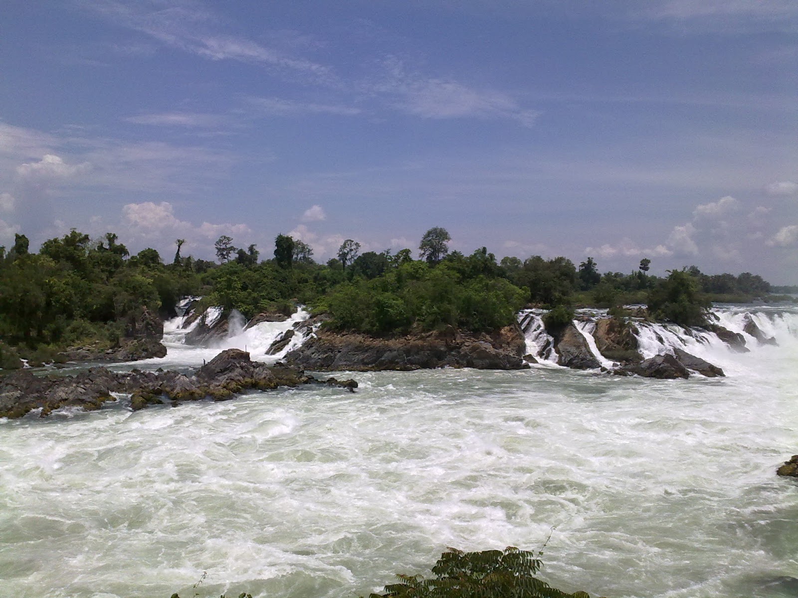
The Khone Falls are the largest in Southeast Asia - the highest falls reach to 21 meters. These falls are the reason that the Mekong is not fully navigable from Viet Nam to China
Because of the falls, the French colonialists could not send gun boats and supplies by river from Saigon up to Vientiane and Luang Prabang. Likewise, they could not get agricultural products exported from Laos by using Mekong. So, they came up with the white elephant project of building a single-track railway between Don Det and Don Khon. It was a temporary railway from 1893, but became longer (seven kilometers in total). and stronger (i. e., permanent tracks, real locomotive) in 1897. 


The last train probably traveled the tracks in 1940 when Japanese troops took over from the French colonial masters. It was the first and only railway ever built, opened and operated in Laos until 2009. 
The area upstream from the falls is characterized by thousands of islands and countless waterways, giving the area its name Si Phan Don or '4,000 islands'. Half of these are submerged when the Mekong River is high at the end of a rainy season. The principal islands of Si Phan Don are Don Khong, Don Det, and Don Khon.   
Freshwater (Irrawaddy) dolphins can sometimes be seen near the southern tip of Don Khon looking towards Cambodia. 


From Don Khon, you can also see the Liphee Waterfall, which is very powerful at the end of the rainy season. Unfortunately, this picture is from my second visit, which was at the end of the dry season. 

Tuesday, February 21, 2012

Kanchanaburi - Off the beaten track (3)

In 2010, I visited the mines at Pilok and briefly mentioned it in a blog.


Last year, I visited Pilok and Somsak Mining Homestay and blogged about it recently. Here is a YouTube link that gives an idea of the drive down into the valley. 


Last year, before reaching Pilok, I stopped at Thong Pha Phum National Park to enjoy the views and to grab a cup of coffee before continuing. Just as we'd parked our cars, a big bird crash landed and started rummaging for food. 
A National Park officer came out and explained this bird had become so accustomed to people that it no longer was "shy" or scared of people. We even managed to hand-feed the bird some grapes before venturing on. 
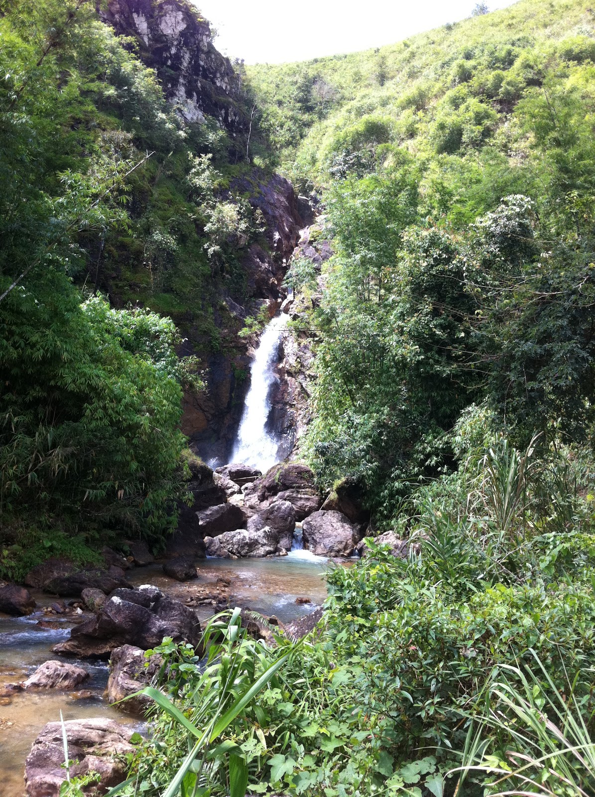
The next stop before continuing to Somsak Mining (see previous blog) was Chokkadin (or Jokkadin) Waterfall. 

The road leading down to the waterfall has some steep declines / inclines and (especially during the rainy season) some deep ruts. If your vehicle slides into the deep tracks - as happened for my friend's pick-up - then even 4WD cannot ensure that you can get yourself unstuck without help. 

In our case, it required a lot of digging before the truck got out of trouble and back on the right track. 

We then continued and reached a grassy swampy area from where we walked to the waterfall. Other off-road people are so lazy that they continue driving on the river bed to reach the foot of the waterfall. This shows little respect for nature and can anyway not be recommended during the rainy season where the water level can be too high for a vehicle without snorkel to handle.