Sunday, March 25, 2012

Laos - Viengxay Caves


Access to one of the most secret sites from the Vietnam War era was allowed in 2008. The caves at Viengxay, in north-eastern Laos, once hosted the country's communist revolutionaries as they plotted the final US defeat in Indochina. Even now. it takes more than a day to drive to Viengxay from either Vientiane or from Luang Prabang.

During the secret war in Laos it was almost impossible to access that area. The remoteness of this "hidden valley" was one reason that the communist Pathet Lao chose it as its headquarters. The other was that the valley is full of natural caves - nearly 500 of them.

Per head of population, Laos remains the most heavily bombed country ever. In a nine-year-long undeclared war the US dropped half a ton of bombs for every inhabitant. It was a desperate attempt to prevent the North Vietnamese communist forces using Laos to supply their forces in South Vietnam and to prevent the Lao communists taking over the country.

At one point, there were around 23,000 people living in the caves. And the community had everything from factories to make uniforms, to hospitals, to rooms in which the war was planned.

Not all the caves are open to the public, but it is possible to visit the leaders' caves and some of the other more significant places - such as the theater cave where visiting song and dance troupes from friendly socialist countries came to entertain the revolutionaries. 


Conditions were basic at best, even for the senior leadership. The Communist Party bosses - the politburo - lived on camp beds in one room, while the leader of the party, Kaysone Phomvihane, had slightly more spacious accommodation through a tunnel which he shared with his children.

After the war, the area remained off-limits to foreigners because it was used to "re-educate" senior officers of the former anti-communist army.

Laos is the poorest country in South-East Asia, and the caves are in the poorest region of Laos. The local community, hopes that by opening up the former "secret city" of Viengxay to travelers, the area will have a chance to benefit from what, until now, has been an unhappy legacy. 


I wish them the best of luck as I love to visit "adventure destinations" like this one. 

Saturday, March 17, 2012

Thailand - Love Me Long Time


A really authentic and honest "documentary.. 
Especially Nit (the Thai woman - obviously from Isan - interviewed on the beach) provides interesting and seemingly honest "background info".


It's filmed in Lamai (Koh Samui) and Had Rin (Koh Phang Ngan). I cannot recognize Had Rin. When I was there (which year that was shall remain undisclosed), there was no electricity and almost no people. Backpakers stayed in simple huts, played guitar around bon fires on beach, and chilled.

I'm always surprised how foolish Western men becomes in Thailand. They fall in love without understanding the socio-cultural and economic background of the women. They think they are loved back ... fools !


The Thai intro-song is an old (1995) hit .. one of my all-time favorites. It is  a very romantic song about how difficult it is meeting the right man and now that she's finally found him, she's telling him how much she loves him .. .sung by Tata Young (a British father, Isan mother). 

Sunday, March 11, 2012

Laos - Champasak (Si Phan Don)

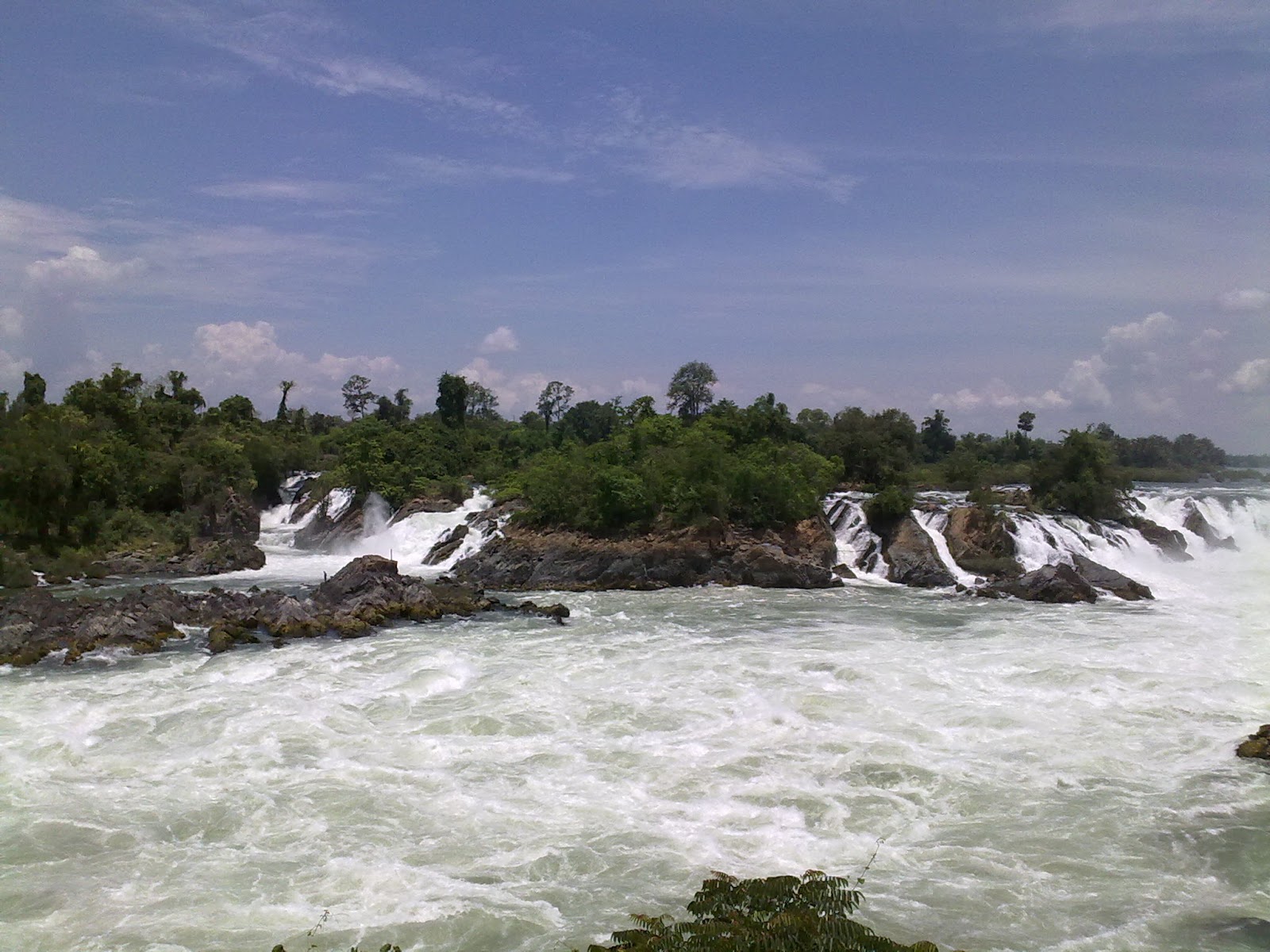
The Khone Falls are the largest in Southeast Asia - the highest falls reach to 21 meters. These falls are the reason that the Mekong is not fully navigable from Viet Nam to China
Because of the falls, the French colonialists could not send gun boats and supplies by river from Saigon up to Vientiane and Luang Prabang. Likewise, they could not get agricultural products exported from Laos by using Mekong. So, they came up with the white elephant project of building a single-track railway between Don Det and Don Khon. It was a temporary railway from 1893, but became longer (seven kilometers in total). and stronger (i. e., permanent tracks, real locomotive) in 1897. 


The last train probably traveled the tracks in 1940 when Japanese troops took over from the French colonial masters. It was the first and only railway ever built, opened and operated in Laos until 2009. 
The area upstream from the falls is characterized by thousands of islands and countless waterways, giving the area its name Si Phan Don or '4,000 islands'. Half of these are submerged when the Mekong River is high at the end of a rainy season. The principal islands of Si Phan Don are Don Khong, Don Det, and Don Khon.   
Freshwater (Irrawaddy) dolphins can sometimes be seen near the southern tip of Don Khon looking towards Cambodia. 


From Don Khon, you can also see the Liphee Waterfall, which is very powerful at the end of the rainy season. Unfortunately, this picture is from my second visit, which was at the end of the dry season. 

Tuesday, March 6, 2012

Laos - Champasak (Vat Phou)

Champasak province can be reached from Thailand through the Chong Mek (Thailand) Vang Tao (Lao) border crossing. From Vang Tao, the road leads east towards the city of Pakxe, the province’s largest city. 

Champasak has a long history that begins with participation in the Funan and Chenla empires between the 1st and 9th century AD. Between the 10th and 13th century, Champasak became a part of the Angkor Empire. 

Following a gradual decline since the 15th century, it was enfolded into the Lan Xang kingdom but then broke away to become an independent kingdom. The short-lived Champasak kingdom had only three monarchs: Soi Sisamut (1713-37), Sainyakuman (1737-91) and finally Fai Na (1791-1811).

Vat Phou (Wat Phu if transliterated according to Thai rules) was a part of the Khmer (Angkor) empire in the early 10th century. At its height the temple and nearby city formed the most important economic and political center in the region.

The Vat Phou temple complex was designed as a worldly imitation of heaven and fitted into a larger plan that included a network of roads, cities, settlements and other temples across present-day Cambodia, Laos, and Thailand. 

Wat Phu is located on the slopes of the Phu Pasak mountain range and it is quite a climb (the steps are steep) to get up to the sanctuary. From up there, however, the view back down makes the climb well worth-while. 
The temple ruins now seen are the product of centuries of building, rebuilding, alteration and addition, with the most recent structures dating from the 11th century. Minor changes were made during the following two centuries, before the temple was converted to Theravada Buddhist use.
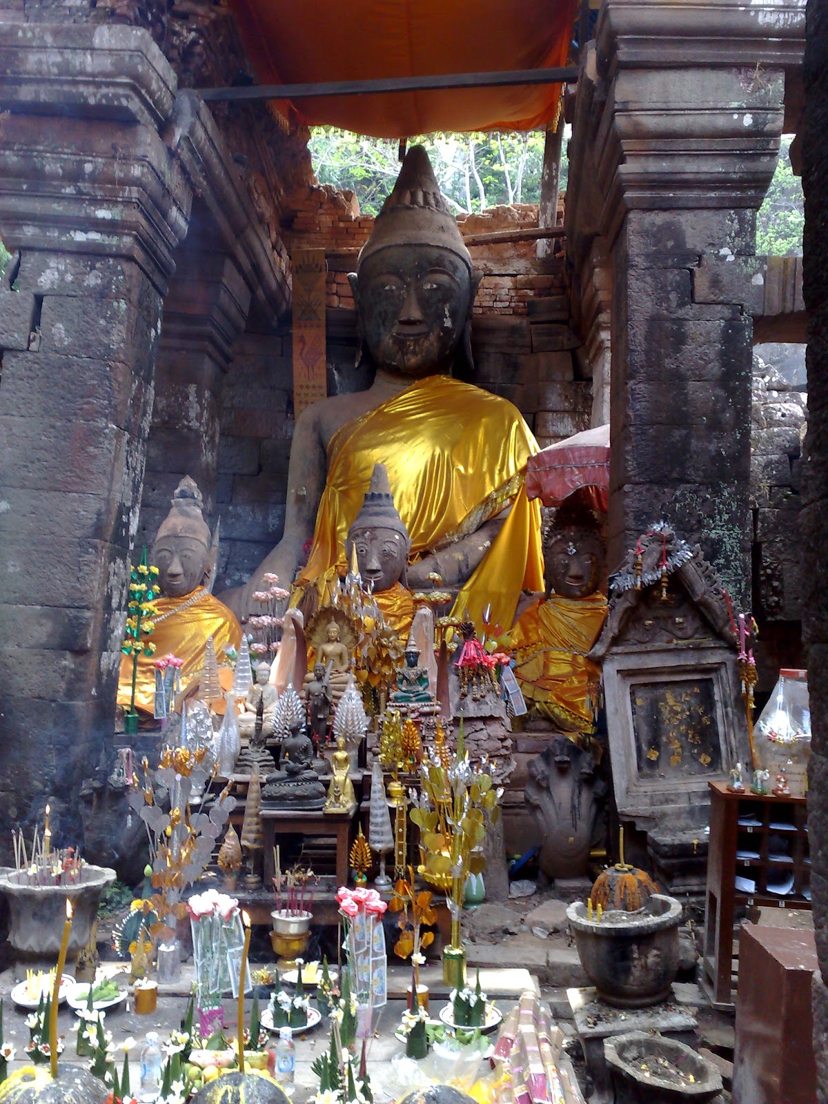
From the cliff wall, water flows from a natural spring some 60 meters to the left of the sanctuary. This water was once led into the temple to continuously bathe the Shiva-linga. Now, people pray to a Buddha statue. 

The spring water is said to have magic / healing properties and people come to carry it away by the bottle. I also dutifully filled a bottle, but it magically disappeared soon thereafter, so I cannot confirm the water's healing properties. 

Tuesday, February 21, 2012

Kanchanaburi - Off the beaten track (3)

In 2010, I visited the mines at Pilok and briefly mentioned it in a blog.


Last year, I visited Pilok and Somsak Mining Homestay and blogged about it recently. Here is a YouTube link that gives an idea of the drive down into the valley. 


Last year, before reaching Pilok, I stopped at Thong Pha Phum National Park to enjoy the views and to grab a cup of coffee before continuing. Just as we'd parked our cars, a big bird crash landed and started rummaging for food. 
A National Park officer came out and explained this bird had become so accustomed to people that it no longer was "shy" or scared of people. We even managed to hand-feed the bird some grapes before venturing on. 
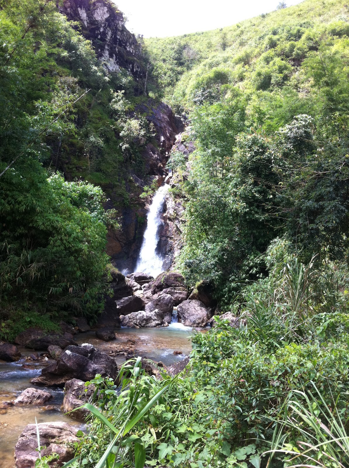
The next stop before continuing to Somsak Mining (see previous blog) was Chokkadin (or Jokkadin) Waterfall. 

The road leading down to the waterfall has some steep declines / inclines and (especially during the rainy season) some deep ruts. If your vehicle slides into the deep tracks - as happened for my friend's pick-up - then even 4WD cannot ensure that you can get yourself unstuck without help. 

In our case, it required a lot of digging before the truck got out of trouble and back on the right track. 

We then continued and reached a grassy swampy area from where we walked to the waterfall. Other off-road people are so lazy that they continue driving on the river bed to reach the foot of the waterfall. This shows little respect for nature and can anyway not be recommended during the rainy season where the water level can be too high for a vehicle without snorkel to handle.

Saturday, February 11, 2012

Kanchanaburi - Somsak Mining

From Thong Pha Phun, off the main road from Kanchanaburi to Sanghklaburi, a narrow route, frequently blocked by landslides, twists through limestone mountains until it dead-ends at the Myanmar border.
Just before Pilok a sign indicates that there is 5.1 km to Somsak Mining Homestay, but warns that the road is rough and only suitable for 4WD vehicles. As usual, such claims are only partially true as there is sufficient traction in the dry season for a normal vehicle to handle the inclines and declines of the road. However, extra ground clearance is a must due to the rocky and pot-holed road, so while no sedan can possible handle the road, a 2WD Fortuner, Hilander or Prerunner should be able to get handle that road in the dry season.

In the rainy season, things can be a bit more challenging if/when rainwater erodes the surface of the already bumpy road.
At the end of the rough road, first time visitors are invariably amazed to discover a few small cottages suddenly popping up in a lush jungle valley. The homely resort is run by a smiling and welcoming farang “auntie”, Glennis, from Australia. She has quite a story to tell.
She met Somsak, a handsome young Thai studying at the school of mines in her hometown of Kalgoorlie. They got married and Glennis arrived in Thailand in 1966. Somsak went to run the tin mining concession that had been in his family’s hands for some 100 years. Pilok was back then a prosperous community. Cross-border trade flourished and the mines attracted workers from Myanmar.

Due to difficulties in accessing Pilok 40 years ago, Auntie Glen lived in Bangkok while Somsak came back to her and their son once a week. When the mining business faltered because of a sharp drop in the tin price, and Somsak got sick, Auntie Glen decided to move to Pilok. She fell in love with her new home in the jungle.
Somsak succumbed to cancer in 1994, a year after mining was halted at Pilok in wake of a worldwide slump in tin prices. Young people left to seek jobs elsewhere. Those who remain eke out a living among ramshackle buildings and forest huts.

Some 240 of Somsak’s former employees remain in the area, among them five families working for Auntie Glen and a Myanmar Buddhist monk taking care of their spiritual needs. Here our 4x4 are parked just outside the tiny temple, which is reached by crossing a small bridge. 
The homely resort consists of two long bungalows in the forest and the converted warehouse for dining and lounging, all imbued with a tropical atmosphere mingling with ceramic bunny rabbits, pastel colored duck-lings, doilies and other Australian Victoriana. There are no telephones and electric power runs just five hours a day.
However, the combination of comfortable weather and a cozy home in the jungle attract travelers - particularly off-roaders. Various stickers on the door indicate just how popular the resort is with various off-road clubs.

Driving from Somsak back to the main road, to Pilok and onwards to Myanmar will reward you with some amazing views. From atop, you can see a small village nestled in the valley below, right on the Thailand-Burma border. Huge gas pipes and telecommunication towers can be easily seen among the small old houses.
That is Ban E-Thong and the pipes are part of the Petroleum Authority of Thailand's 260km pipeline carrying gas from Burma's Yadana field in the Andaman Sea to supply a 4,600 megawatt power plant in Ratchaburi.

Once Ban E-Thong and Pilok were bustling tin-mining towns. Thousands of miners, hundreds of merchants, shops, theatres and a casino kept this place busy around the clock. As they are only located around 50 km from the sea, many Burmese merchants back then came weekly to offer fresh seafood at very good prices.

Now, these towns are very quiet. All the miners have gone, but groups of tourist are now coming. Guesthouses and coffee houses thrive (except in the rainy season) and locals are getting into the tourism business as more and more people discover the joys of hiding away in these remote border towns.

Thursday, February 2, 2012

Caravan

A phenomenon that has gained popularity in Bangkok is "caravan trips", i. e., group trips / tours by means of driving your own vehicle. At first, caravan trips were one or two days events to explore the areas near or around Bangkok. Since then, it has developed into trips lasting 5-15 days and going as far as to South Vietnam via Laos or to Southern China.
.
There are also caravans for special interests such as off-road driving and then you better prepare your car with snorkel, winch and A/T tires.

The increased interest in caravan trips was surely the inspiration for a very popular Thai movie from a few years back:

http://www.majorcineplex.com/movie_detail.php?mid=556


The movie is a romantic comedy where the background story is aa road trip through southern Vietnam (from Hue to Dalat) and the scenery is quite stunning.